We’re pleased to announce version 1.5 of our iPad mobile maps app, available immediately on the App Store. This version brings support for GeoJSON layer sources, as well as some sharing features that help you more easily get information into and out of the app.
GeoJSON
GeoJSON works just like KML and GeoRSS already do in the app, allowing you to use this lightweight format to represent points and lines and to have them drawn as vector shapes on map layers. A lot of the open data sites we’ve been releasing, such as the Violence Against Journalists in Afghanistan site, allow you to download the source data as GeoJSON. We’re happy to be able to more closely integrate our sites and our tools in this way.
Snapshot sharing
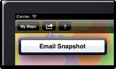
During the development of this update, we noticed that getting information into and out of the app could be easier. Off the top, we wanted to make it easier to share snapshot images of maps. While we’ve supported this from the start, you needed to go into the documents browser, view a saved map, and then send a snapshot of it. We’ve added the ability to share a snapshot of whatever view you are looking at currently, right from the main toolbar.

Better URL integration
Another issue we noticed is that certain text-based file formats, including GeoJSON, open natively in Mobile Safari, displaying just like web pages. Unlike formats such as KML or PDF, which allow you to open them in another app right from the document, these formats get “dead ended” in Safari. While we’ve made a feature request around this to Apple, in the meantime we wanted to help work around that. We came up with two approaches.
The first was to register two custom URL protocols — mbhttp: and mbhttps: -- that open our app from anyplace else on the system. This allows you, when on a page in Safari, to edit the URL in the location bar, add mb to the beginning, hit Return, and have the URL passed directly to the MapBox app. If the URL points to a supported format, such as GeoJSON or KML, the data will be imported as a layer.
The second approach is based on the system “clipboard” (to borrow a desktop term). If you copy a supported URL from anyplace in the app, then launch the app, it will notice and prompt you to import the layer. We thought a demo video would help clarify how this works.
We hope these features make it even easier to get data that matters into the app. If you have any feedback, or if you want to follow our work, check out @MapBox on Twitter or start a conversation with us at support.mapbox.com.
What we're doing.
Latest