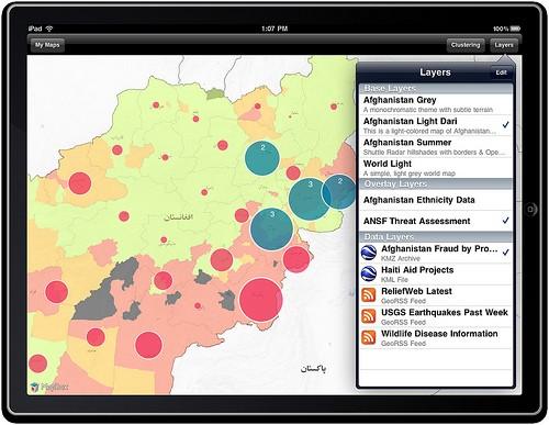
We’re close to shipping version 1.0 of the MapBox iPad app, an interactive mapping app that lets you load highly custom maps — like the ones available on MapBox — on the iPad and visualize GeoRSS and KML over the maps. All the maps and the data run locally, allowing full mapping interaction offline. This post highlights some of the key areas that have been in development lately. Our goal now is to attract a few last pre-release testers to check it out before we go live (email info@mapbox.com if you’re interested).

Data clustering
On the web it often makes sense to do things like convert geographically close points to geographically identical points so that, for example, several stories about New York City would get grouped into a single New York City geo point with a larger circle. On the iPad, however, we have solid front end processing so that when data points from KML or GeoRSS are added to the map, we can do some computation and cluster them dynamically as well as re-figure these clusters based on the map zoom — on the fly.
State saving
The MapBox iPad app is now able to save and restore states on launch or quit automatically. Quitting and coming back to the app should pose no real delay in workflow. This laid some groundwork for general document saving and loading, as well.
Document saving and loading
Hot on the heels of state saving was document support with a Keynote-like browser. This lets you quickly flip the map, glide through previously-saved maps, and load one up with the touch of a button. It’s pretty cool.
Better popups
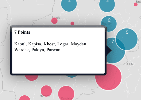
I added better support for contextual popups when showing data like GeoRSS and KML. We now pull descriptive data from KML data itself, as well as create some basic descriptive data to summarize points that are clustered.

Mailing snapshots
I recently added support for emailing snapshots of maps directly from the app. This way you can setup a particular view of data and easily send someone an image of what it looks like in seconds.
If you are interested in maps and have some KML and GeoRSS data, drop a line to info@mapbox.com and let us know what you are working on. Also, last week Wired’s Gadget Labs wrote a post about this work along with some of the other offline mapping tools we’re building for use in projects in countries like Afghanistan that’s worth checking out for more information.
What we're doing.
Latest