
MapKibera: Community Driven Mapping Project in Africa's Largest Slum
- Estimated
- 1 min read
MapKibera, a project to create the first complete, free, and open map of Kibera in Nairobi, Kenya, begins next week. Organized and led by Mikel Maron of the Open Street Map Foundation, this is a fantastic example of how the OSM approach can be used to build community, provide technical training, and create valuable data in parts of the world where open and accurate data does not exist. I’m lucky enough to be here in Nairobi for the start of the mapping and will spend a few afternoons next week working with the team Mikel has put together explaining some OSM basics and helping out however else I can.
Kibera is widely known as Africa’s largest slum. However it’s a blank spot on the map — the community is entirely unmapped. As explained on MapKibera.org, “without basic knowledge of the geography and resources of Kibera, it is impossible to have an informed discussion on how to improve the lives of residents.
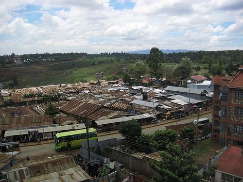
photo by Flickr user junipermarie
MapKibera will partner students from Kibera with members of the Nairobi tech community. Teams will collect data in the mornings using GPS and Walking Papers and spend the afternoons entering the data using JOSM. Mapping is expected to last through the end of November. More details on the project are available at MapKibera.org and in its press release.
You can follow the project and get updates on the blog and Twitter.
What we're doing.
Latest