A quarterly snapshot of our experimental tools and open-source innovations, showcasing the projects that drive our curiosity forward.

Innovation is at the core of what we do, and every so often, we create experimental tools and projects to tackle challenges in new and creative ways. This list highlights some of the exciting work we’ve done collaborating with partners and the open-source community. These projects explore the boundaries of technology in bioacoustics, geospatial data, cloud computing, and more. Here’s a snapshot of what we’ve been up to:
1. Powering Global Wildlife Sound Discovery with Machine Learning
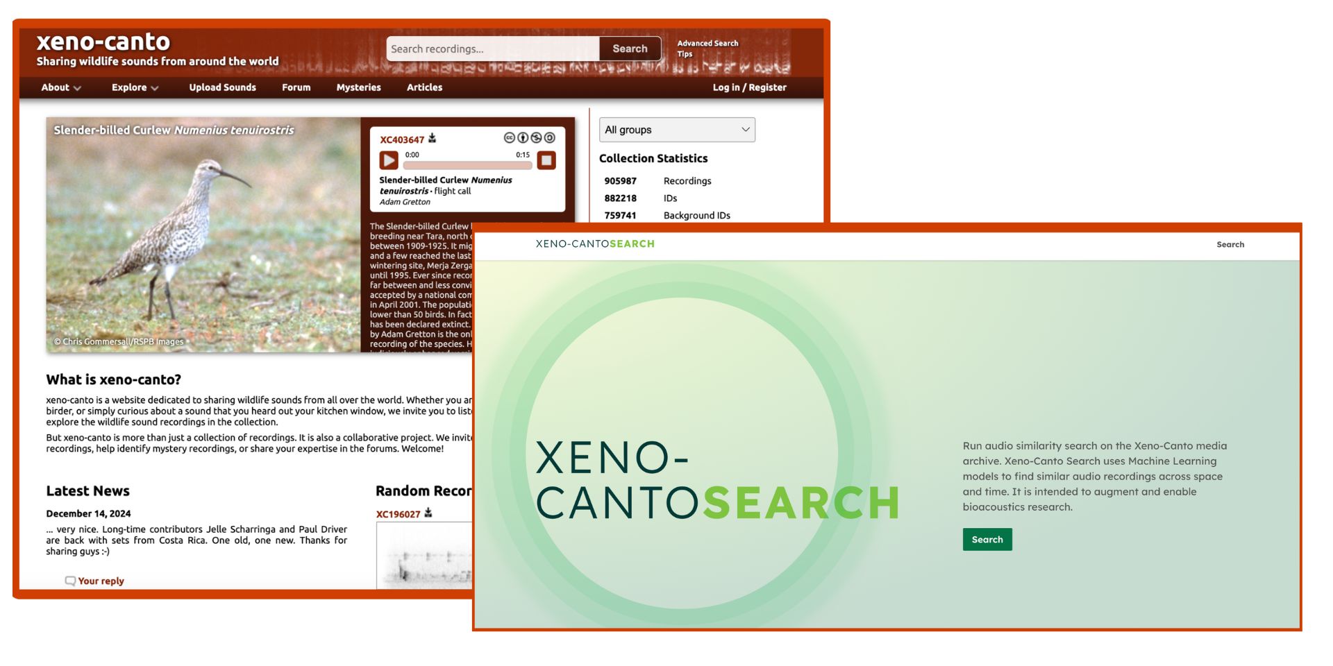
Last year, we collaborated with Google and the Australian Acoustics Observatory to develop a search application for wildlife ecosystem monitoring. This project used Google’s Perch ML model to generate audio embeddings and Milvus for vector search. Building on this open-source work, we prototyped a bioacoustics search platform for xeno-canto, a leading wildlife sound-sharing community supported by the Naturalis Biodiversity Center. This platform enables researchers to discover similar audio recordings across space and time within xeno-canto's extensive open media archive. By comparing labeled samples, it opens new possibilities for identifying untagged recordings, paving the way for novel bioacoustics research.
Check out Xeno-canto Search here.

Xeno-canto search.
2. Animating Trip Data with Lonboard’s 0.10 Release
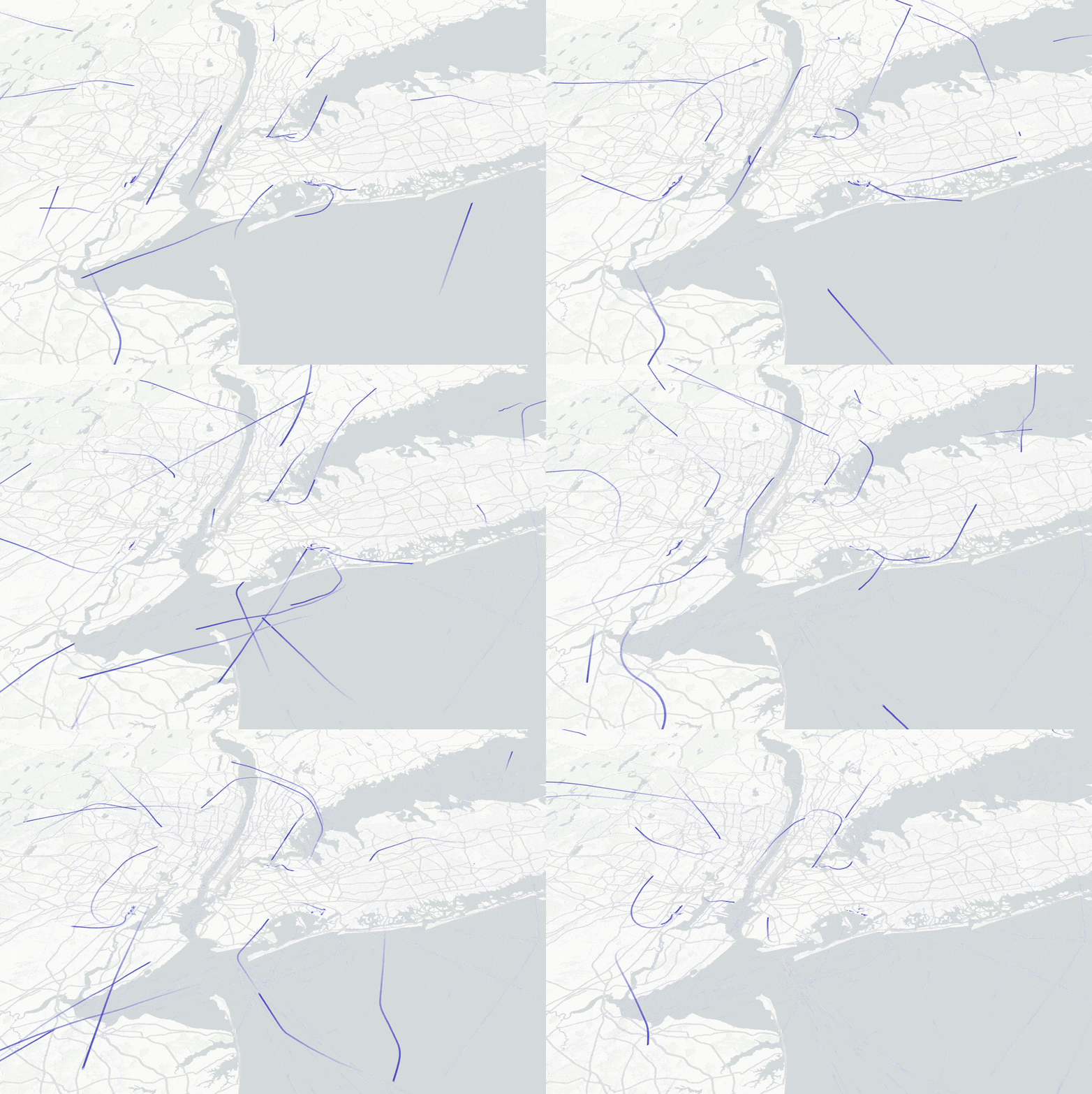
Lonboard’s 0.10 release introduces the TripsLayer for animating trajectory data on interactive maps directly from Python. This feature enhances visual storytelling and integrates with MovingPandas for advanced movement analysis. Additional updates include a ColumnLayer for rendering extruded cylinders, bounding box drawing, and Pyodide support for running Python in-browser. The release reduces dependency requirements, making geospatial visualization smoother and more accessible.

Lonboard's TripsLayer in action.
3. Faster and Easier Access to Object Storage from Python
obstore is a high-performance library designed to streamline cloud-based data storage operations in Python workflows. Initially conceived as a necessity when object-store-python lacked maintenance, obstore has evolved into a performant alternative to fsspec. It supports various cloud providers and simplifies complex data management tasks, boasting improved performance and new cloud backend support in its latest version.
import obstore as obs

store = obs.store.MemoryStore()

obs.put(store, "file.txt", b"hello world!")
response = obs.get(store, "file.txt")
response.meta
# {'path': 'file.txt',
#  'last_modified': datetime.datetime(2024, 10, 21, 16, 19, 45, 102620, tzinfo=datetime.timezone.utc),
#  'size': 12,
#  'e_tag': '0',
#  'version': None}
assert response.bytes() == b"hello world!"

byte_range = obs.get_range(store, "file.txt", offset=0, length=5)
assert byte_range == b"hello"

obs.copy(store, "file.txt", "other.txt")
assert obs.get(store, "other.txt").bytes() == b"hello world!"
4. Agent-Based Geospatial Queries with LLLLM
LLLLM (Lat-Lng-Large-Language-Model), or “L4M,” is an experimental toolkit for integrating geospatial queries into large language model interactions. With tools like MercantileTool (for tile retrieval), GeoPyTool (for geocoding and distance calculations), and OSMnxTool (for OpenStreetMap data access), LLLLM acts as an intelligent router to determine the best tool for a given geospatial task. This project pushes the boundaries of LLM capabilities in geospatial contexts. Stay tuned for more LLM discussions from us in the new year.
We're thrilled to share our ideas with you!
5. Simplifying Access and Monitoring of City-Level OpenStreetMap Data
In 2023, we introduced OSM for Cities, an open-source initiative aimed at simplifying access to city-level OpenStreetMap data. With features like daily updates, 30+ preset datasets (e.g., hospitals, bike paths, schools), and polygon-based city boundaries, OSM for Cities empowers local governments and citizens to make informed decisions on sustainability initiatives.
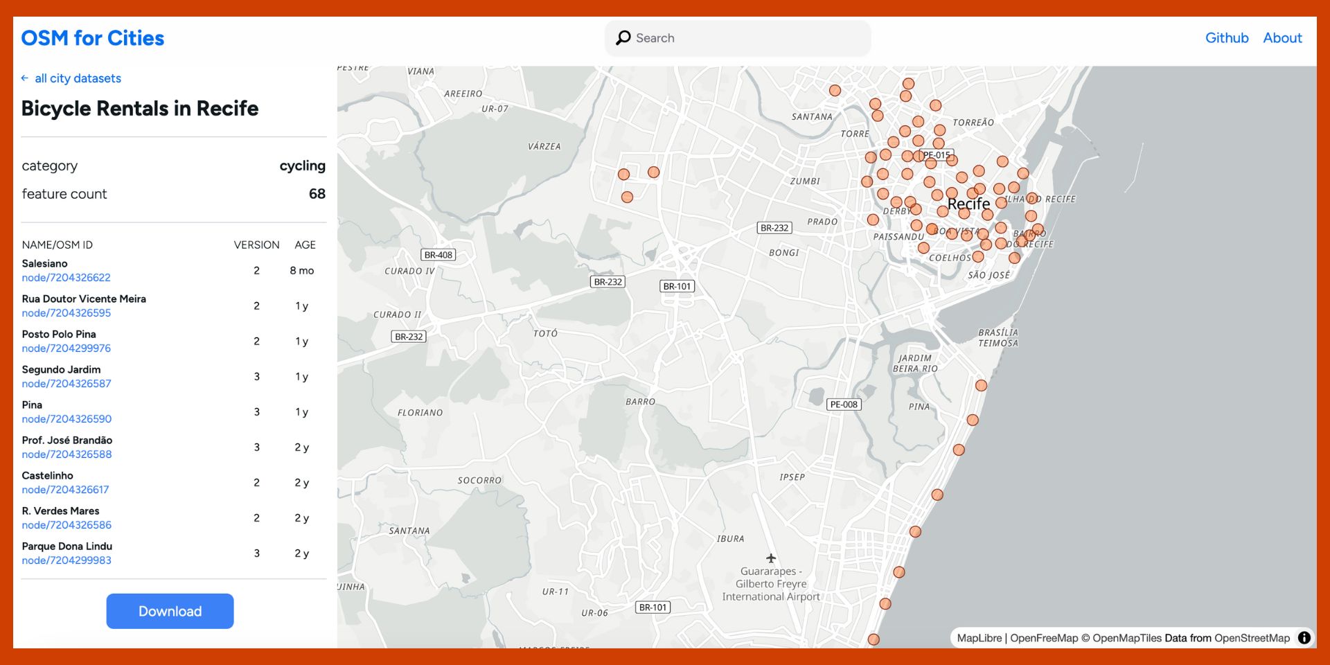
This month, at State of the Map Latam 2024, we presented the latest version of the platform, which introduces an interactive map of datasets, making it easier to explore and download city-level data. The new feature enhances usability by visually representing available datasets and their boundaries, streamlining data discovery and accessibility.
Check out OSM for Cities site or the GitHub repo.

OSM for Cities makes access to OSM datasets easier.
Join the Fun
These projects started as our own "what if?" moments and side quests – from wrestling with cloud storage frustrations (looking at you, obstore) to wondering if we could make LLMs understand geography. They're not polished projects, but rather the results of curiosity-driven tinkering and solving real problems we encountered along the way.
We're sharing these experiments because we believe the best innovations happen when communities build together. We'd love to know what you think. Dive into our repositories, fork away, and let's build something cool together! 🚀

We're thrilled to share our ideas with you!
Related content
More for you
What we're doing.
Latest
