
Water Management for a Sustainable Future
- Estimated
- 5 min read


To monitor water resources in a way that considers the effects of climate change, we must significantly improve our monitoring methods. However, gathering water metrics presents substantial challenges. Traditional methods, using in-situ devices or conducting manual field visits, are not easily scalable and only provide limited information for small areas. Satellite imagery offers immense scalability but requires sophisticated technical expertise to extract relevant information from the imagery and sensor data to make it practically useful.
Using satellite data analysis and artificial intelligence, we help address these challenges. With our extensive experience in this area, we're building tools to monitor inland water quality, melting glaciers, marine pollution, and hurricanes.
Our latest effort in this area is a water basin monitoring project that has the support of the European Space Agency (ESA), the CEO Water Mandate and Water Resilience Coalition. Our European team will lead the development of an inland water body monitoring that will rely on multiple open-data satellites. We will partner with water organizations to facilitate access to these data through an open API propelling their products and research forward.
Let's take a look at some of our water resource monitoring projects.
1. Water Health Indicator Service
The Water Health Indicator Service (WHIS) will provide a continuous data stream of environmental health indicators for inland water bodies. This service will be an API with monitoring and reporting capabilities that allow you to track a set of specialized and highly descriptive Water Health Indicators. Indicators will be physical descriptions derived from satellite remote sensing, such as water extent, turbidity, chlorophyll concentration, and evapotranspiration.
One key advantage of EO-derived indicators is their harmonization in time and space. They are computed with the same method and based on the same input data, regardless of the observation date or geographic location. Sources like the Harmonized Landsat Sentinel-2 (HLS) dataset help make the indicators consistent without the usual overhead of massive data processing.
The WHIS project is developed with our partners at MARE and EDP Labelec. It is co-funded by the European Space Agency (ESA) under the ARTES 4.0 Business Applications – Space Solutions program.
2. Water Attribution and Variability Experiment
Water Attribution and Variability Experiment (WAVE) is a DevSeed Labs project. We developed prototypes for repeatable workflows for deriving turbidity maps using the Normalized Difference Turbidity Index (NDTI) for inland water bodies. We adopted two approaches, one scientific with custom atmospheric correction and cloud masking using L1C data and another speed-focused with L2A data.
Both methods show promise in providing valuable water clarity information. The experiment included a validation workflow that examines correlations between ground truth turbidity measurements and Sentinel-2 NDTI measurements. The validation results are promising; however, more work is needed to evaluate the precision of the derived indicators.
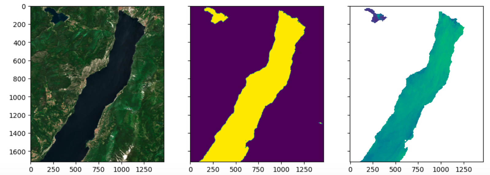
Turbidity over Lake Guarda, Italy. From left to right: Visual image, Water Mask, Turbidity Index.
3. Detecting Supraglacial Lakes for Glacier Dynamics
We partnered with NASA IMPACT to detect supraglacial lakes to understand their vital role in glacier dynamics and sea-level rise. We are using satellite imagery and labels from NASA Operation IceBridge and SGL occurrences in PlanetScope imagery to detect the lakes. We have developed a supervised semantic segmentation model that accurately detects supraglacial lakes. This knowledge fuels effective water resource management in glacial regions, ensuring their sustainability in the face of climate change.
We wrote a more detailed blog post on our work, and the underlying code is available through an open repository.
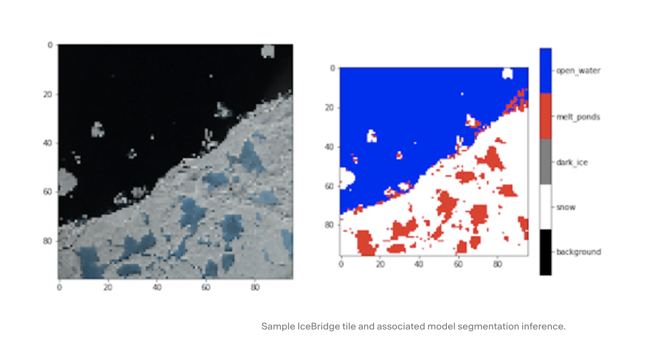
Detection of supraglacial lakes
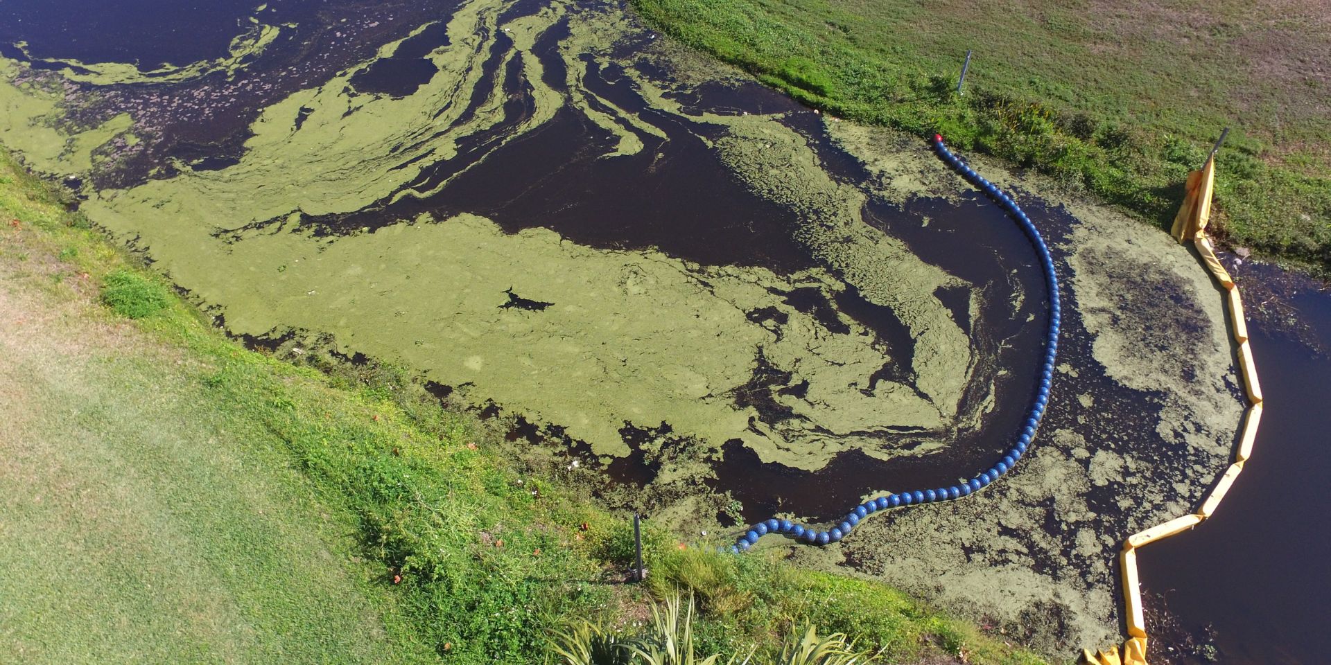
4. Addressing Oil Spills with SkyTruth
Development Seed partnered with SkyTruth to implement an innovative technological solution to detect and combat the illegal dumping of oily wastewater, or "bilge water," from ships into the ocean. Using the Sentinel-1 satellite platform and AI techniques, the project identifies oil slicks that change the back-scatter behavior of light over the water. Once an oil spill is detected, it is correlated with the GPS tracks of shipping vessels to identify potential offending vessels.
The detection of oil slicks was made possible through segmentation and object detection models, addressing challenges such as slick diffusion and potential false positives. We deployed this solution on Google Cloud and integrated it into the SkyTruth global exploration and monitoring tool. You can explore results through SkyTruth Alerts. SkyTruth has created a great explanatory video about illegal oil spills. By successfully implementing this technology, we offer authorities a robust tool for maritime pollution control that helps them identify polluters and hold them accountable.
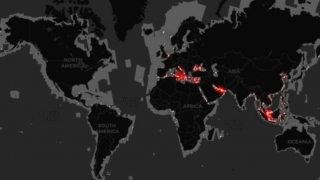
Global oil spill occurrences detected through our work with SkyTruth.
5. Assessing Hurricane Intensity and Water Impact
In partnership with NASA IMPACT, our project on hurricane intensity employs satellite data and advanced analytics to track the severity of hurricanes and their impact on water resources. We gain invaluable insights into their ecological and hydrological consequences by monitoring water bodies during and after hurricane events.
This investigation applies convolutional neural networks to satellite data feeds to estimate the tropical cyclone intensity in near real-time objectively. This information enhances disaster response and preparedness, improving water resource management in vulnerable regions. You can explore hurricane intensity estimates on the interactive portal in near real-time.
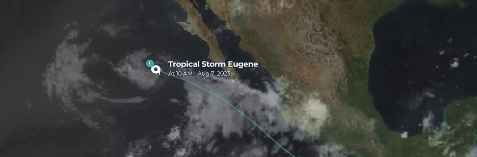
Tracking tropical storm Eugene
6. Detecting Marine Debris for Ocean Protection
Ocean plastic pollution has a devastating impact on marine biodiversity. Marine debris is litter that has been released into the oceans by humans accidentally or intentionally. Once seaborn, the debris usually intermixes with natural materials or vegetation such as algae, seaweed, and driftwood. We used satellite data and AI-driven detection and monitoring to combat marine debris, mainly plastic waste. In this work with NASA IMPACT, near real-time data on marine debris distribution empowers global initiatives to reduce plastic pollution and safeguard our oceans and marine ecosystems. Check out this blog post about marine debris.
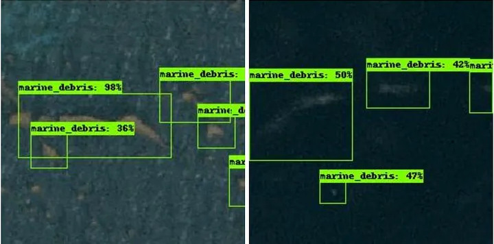
Marine debris detected by our deep-learning model
Working Towards a Water-Resilient World
The projects we've shared here show what is possible when earth observation data is fused with advanced AI methods. We're eager to tackle more complex water challenges head-on. If you are interested in working with us to protect our water resources for future generations, send us a note. You can also meet Martina and Daniel at the World Water Week in Stockholm later this month.
What we're doing.
Latest