Today we launched the alpha version of Skynet Scrub, a tool for cleaning the outputs of Skynet, our machine learning and recognition process. This is part of our larger effort to build end-to-end machine learning pipelines that deliver usable insights to humanitarian and global development organizations.
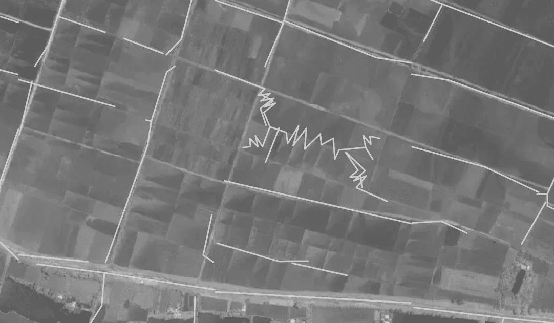
Machine learning and recognition can quickly extract insights from vast amounts of satellite imagery. Currently, we use Skynet to reliably extract roads and buildings from satellite imagery. Skynet gets more capable every day, but the output is still not perfect, and in the less-developed regions where Skynet is most useful, the challenge is often finding good, rich training data.

Our output still has the occasional spaghetti.
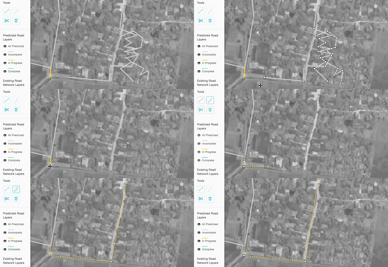
We built Skynet Scrub so we could start using Skynet data sooner. It’s our take on a familiar tool, the map editor, and it’s focus is on cleaning the squiggly false positives from machine-learning algorithms.
Automated feature extraction is in beta.
We’re pushing machine learning to pick out roads and buildings because it can reshape mapping. It could provide, for example, a roads planner an accurate map of the existing network, using data sent from a satellite that flew overhead yesterday.
The results are getting good, but not accurate enough to use out of the box yet.
For urban planners or first responders, any false positive in geographic data is unacceptable. Existing tools for working with geographic data can also be clunky or ill-fitting for the job.
Made for cleaning
Skynet Scrub is for cleaning, and cleaning quickly. It has a small feature set by design, backed by strong hotkey support for power users. It supports completeness tagging, and knows to cache your work as you go. It runs in a web browser.

It’s powered by Skynet Scrub Server, a dead-simple API for geographic data.
We’re working on multi-session support now, and filling out the roadmap. Skynet Scrub is still in it’s early stages, but we’re deploying it with some regional partners for field testing.
We’re building in the open on Github, and welcome trackers and contributors at Skynet Scrub and Skynet Scrub Server.
Part of a whole
As you may have noticed, we’ve been putting a lot of energy into extracting features from satellite images using machine learning. Taking an image and identifying roads, buildings, or other relevant features has tremendous potential for governments, nonprofits, and the private sector alike.
To realize this potential, we need an open-source, web-based solution that’s end to end. And until the output is good enough to put directly into use, Skynet Scrub is a missing piece of this puzzle.
What we're doing.
Latest
