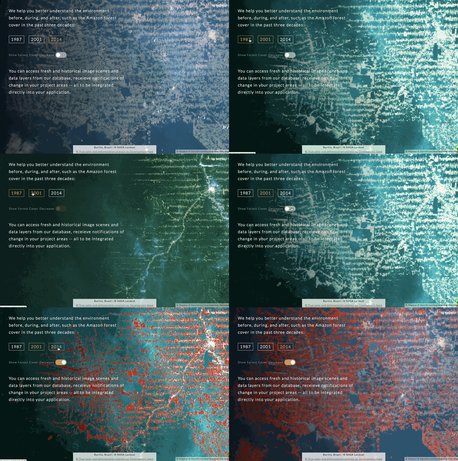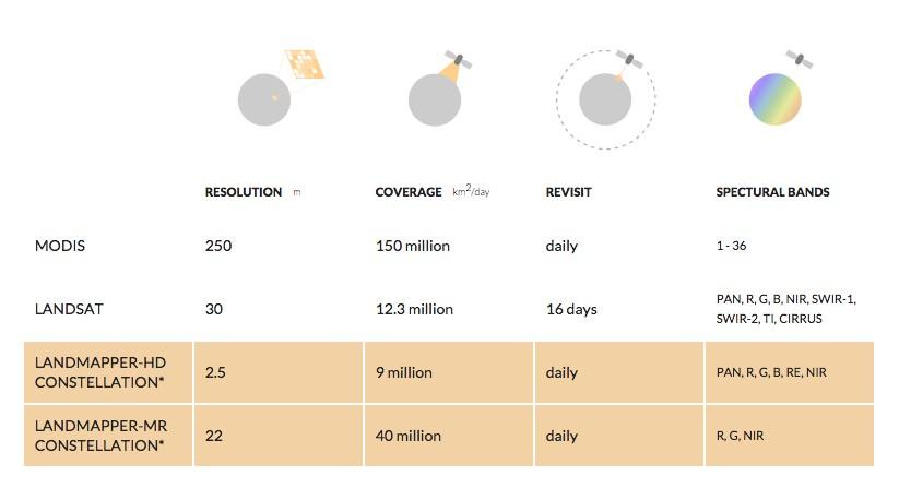
We’re collaborating with Astro Digital now as they build out integration and visualization tools — from antenna to API, that makes image acquisition, analysis, delivery, and integration easier for both NGOs and enterprise. Astro Digital is building an API to empower developers to access fresh and historical imagery, compute needed data layers on the cloud, and harvest data in ready-to-use format. Their cloud platform can do heavy analysis and feed data directly into applications. By directly integrating with the Mapbox API, we can quickly deploy sophisticated and beautiful applications from agriculture to disaster response using the platforms that developers are already building on.

We’d love to see more satellite providers compete on ease of integrating their data. We’ll be helping Astro Digital to review their API to make it developer friendly and we will build open source tools on top Astro Digital’s API. These tools will serve as open templates for integrating Astro Digital with tools like Mapbox to quickly build powerful, data-rich sites. This is really positive move for the industry and for users.
What we're doing.
Latest
