

I spent some time this weekend looking at global accessibility data provided by the Global Environmental Monitoring Unit from the Joint Research Centre of the European Commission. The results are some stunning insight into rural populations and accessibility to services. Custom Legend Edit descriptionbl.ocks.org
View the full screen map here.
Around the world, access to services matters. From traveling to the nearest health clinic, to time to market for goods or food, travel time and distance matter to the health and livelihood of communities.
This dataset looks at travel time to nearest city with 50,000 or more people. While this particular dataset is nearly a decade old, it still offers some remarkable insight. It shows the challenges that governments face providing services from transportation to health clinics to polling stations. Similar to the malaria mapping we’ve done the past, this map layered with additional information would provide NGOs and policymakers provide with useful strategic and operational insights.
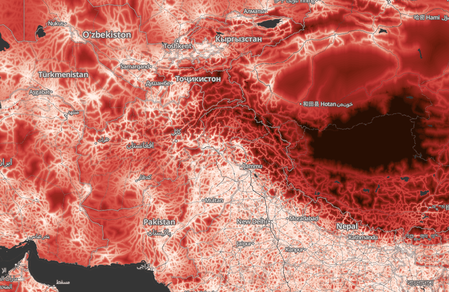
Variability of access across central and south Asia. The dark area on the right is the northern part of Tibet.
What we're doing.
Latest