WhereCamp, an unconference held annually in the Bay Area and elsewhere throughout the year, draws people from around the world to discuss their best ideas around mapping technology. The great thing about an unconference is that spur of the moment ideas often lead directly to actionable coding, and projects are instantly born over late night sessions. I’ve attended WhereCamp now for several years, and the most exciting trend I have seen is the growth of technology driven by artistic ideas and community needs.
We have been presenting how TileMill and TileStream can enable a new generation of storytellers to visualize and share maps easily with open source tools. This has led to hacking sessions with friends at Stamen Design about how web standards like CSS can be further leveraged to make styling beautiful custom maps even easier.

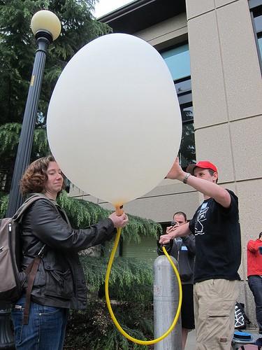
We spent a lot of yesterday dashing around in the sun chasing balloons with Jeff Warren, who is instructing us on cheap and creative ways to aerially map a place with handmade tools. Jeff wrote Cartagen Knitter, a tool that enables people who collect aerial images with balloons and kites to stitch the images together into actionable geo data. We see a huge opportunity to establish linkages between Cartagen Knitter and TileMill that would allow grassroots data collected like this to be easily combined with other maps and even used offline in the MapBox iPad app.
We have also simply been in awe at the creation of gorgeous woodcut maps by Gabe Smedresman, who has used open source tools to generate templates from geo data that then can be laser cut into framed masterpieces by local artisans and wood workers.
Day 2 of WhereCamp kicks off today. We want to thank Anselm Hook in particular for organizing an amazing event.
What we're doing.
Latest