
With a historic inauguration tomorrow, we thought we’d take a minute to look at some of the maps available around the internets that give us a peek of historic Washington, DC.
The National Capital Planning Commission makes some great maps available like this engraving of the original L’Enfant Plan:
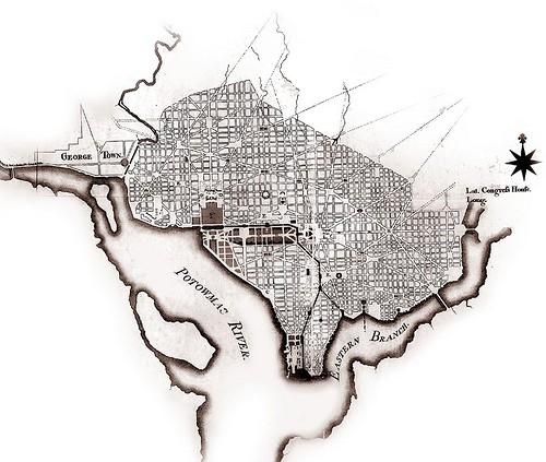
A georeferenced scan of the 1791 plan for the District can be requested from the DC Office of Planning here.
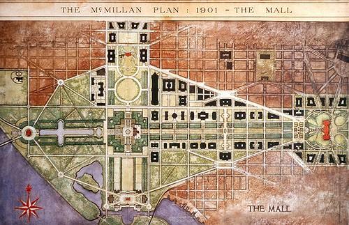
The 1902 McMillan Plan, which gave us Union Station and much of the shape of the National Mall, was the result of collaboration between the legendary Daniel Burnham, Frederick Law Olmstead, and others. While we couldn’t find any GIS data for the plan, we did discover that it is available for download via pdf from The National Parks Service
Today, thanks to the DC GIS Data Clearinghouse, much of what you need to create great contemporary maps of the District is online and freely available. We were first introduced to the clearinghouse through the Apps for Democracy contest this past November. We had a lot of fun building DC Bikes and Stumble Safely. Congrats to the organizers for their nomination for a UN Public Service Award.
The DC GIS Clearinghouse also has a number of other historic data sets, including census tracts dating back to 1930, the 1815 Latrobe Survey, and a number of relief maps and more recent orthophotos.
Have a great time at all the inauguration festivities. We’ll see you down on the Mall.
What we're doing.
Latest