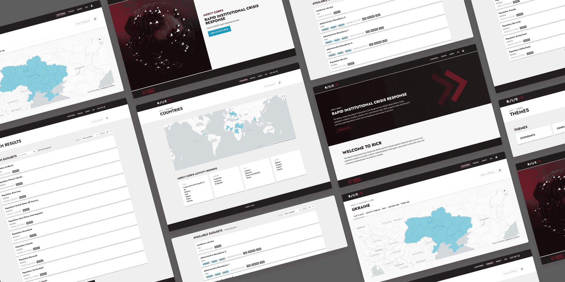
The Mercy Corps Data Rapid Institutional Crisis Response (RICR) tool is a critical improvement in enabling data-driven crisis management. Featuring advanced cloud-based ETL pipelines and a user-friendly web interface, RICR ensures continuous data updates and easy access. This tool empowers early-stage response teams with critical, real-time data, facilitating faster and more effective humanitarian actions.

Overview
The Mercy Corps Data Rapid Institutional Crisis Response tool (RICR) allows Mercy Corps analysts to analyze, visualize, interact with, and interpret data. RICR supports early warning and pre-crisis planning efforts within the humanitarian community of practice.
Challenge
When a crisis happens, early-stage response teams need data to plan their actions. The lack of systemic, routinely updated data means that critical aid decisions are delayed, made with limited information, or not made at all.
Outcome
Deploy ETL pipelines in the cloud that provide an always updated data catalog and build an API and a web interface to give users easy access to the data collections. This leads to faster, data-informed decison-making and response.
Mercy Corps is a global humanitarian organization that operates in more than 40 countries and has over 5400 team members working alongside people living through poverty, disaster, violent conflict, and the acute impacts of climate change.
At the beginning of 2022, Mercy Corps brought to Development Seed their challenge to provide data analysis and early response teams the information they needed to act in crisis scenarios. They identified that access to updated data was a pressing issue that degrades or even forbids humanitarian responses.
Mercy Corps Rapid Institutional Crisis Response (RICR) is a data platform that enables data science to support crisis analytics and humanitarian programming. The plan was to set up a collection of Extract, Transform, Load (ETL) pipelines in the cloud that would run periodically. After ingesting the data into RICR via ETLs, we can keep it updated and expose it through a standard API. RICR supports both raster and vector datasets, as well as non-geospatial data.
All these datasets are available through the RICR API and built on open standards like STAC and OGC Web Feature Service, enabling greater interoperability. Users can access data in many formats, like CSV, JSON, GeoJSON, and vector tiles.
We built a user-friendly web interface to search datasets by themes and location. Visualizing the data in the browser and easily copying the API URLs is also possible. We used React and MapLibre GL JS, supporting SSO authentication.
RICR is more than a data discovery platform. It allows the curation of datasets that are ready for analysis through a variety of tools like QGIS, Jupyter Notebooks, or PowerBI — without having to download any of the data. For example, RICR can let anyone build a dashboard tracking conflict and migration data without scraping multiple data sources or APIs.
Interface examples:
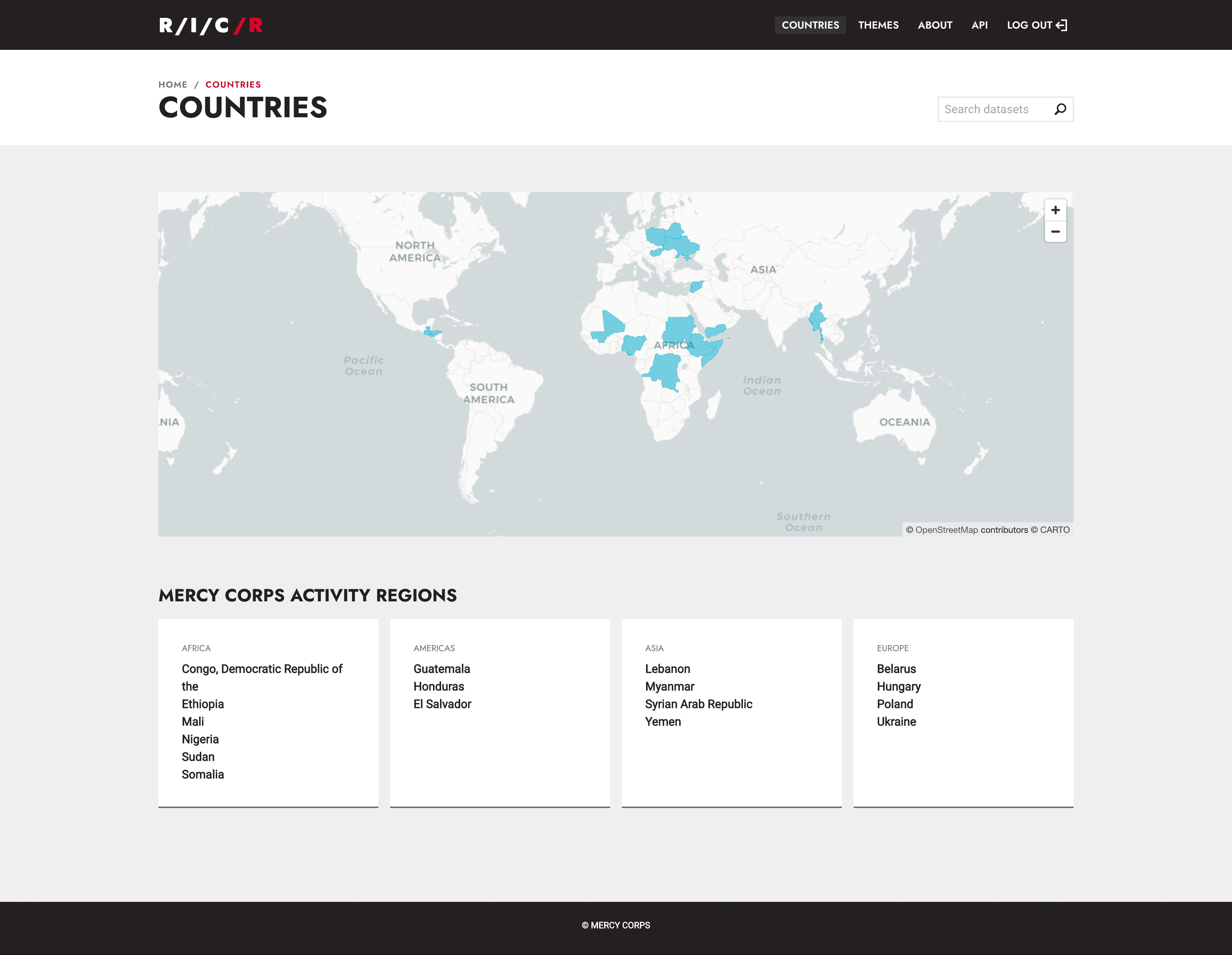
Activity regions page
List and map of activity regions.

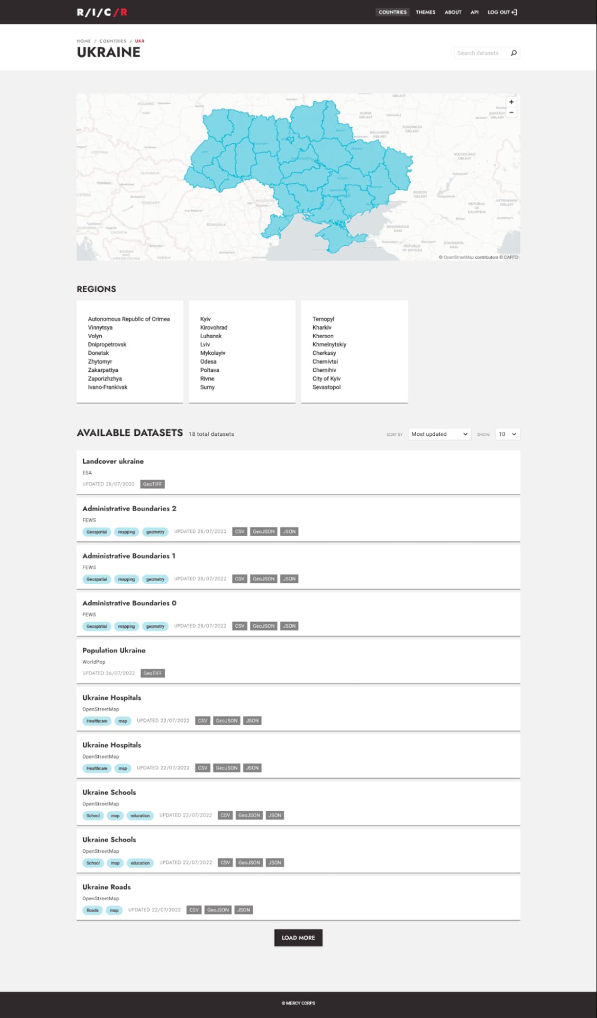
Country page
List of regions and datasets related to a country.

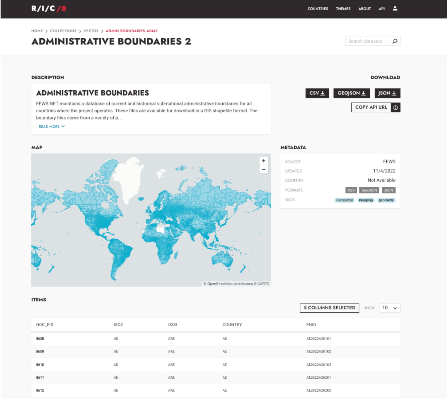
Dataset page
Dataset page, with multiple data format options, map visualization and features list.

Have a challenging project that could use our help?
Let's connect
We'd love to hear from you.