

We’ve been busy with the Zarr community this year: contributing code, building tools, and planning events. Here’s a snapshot of what’s new and where to connect next.

Authors: Max Jones and Davis Bennett
Davis Bennett is an independent software developer specializing in tools for processing large imaging datasets and is an active member of the zarr community. Davis authored the specification and implementation of new Zarr data types and codecs simplification.
Zarr represents a better way to work with massive datasets: open, scalable, and designed for the cloud. We’ve invested in developing Virtual Zarr, advancing Zarr v3 adoption, and convening community events because we believe this ecosystem is key to more accessible and sustainable data infrastructure.
Zarr is a cloud-native open standard for chunked array data. It’s widely used in Earth science and beyond because it makes massive datasets easier to store, share, and analyze in distributed environments. The format has grown quickly thanks to contributions from a broad open-source community, and it continues to evolve with new tools, specifications, and events.
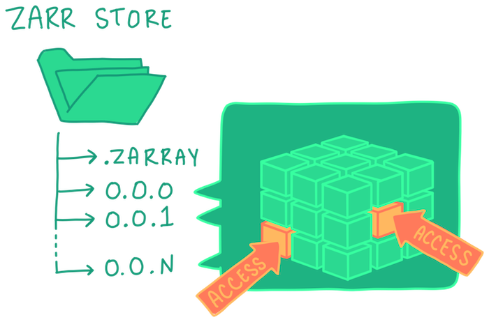
Zarr store, Credit: Gus Becker
Virtual Zarr
Virtual Zarr makes it possible to work with data stored in archival file formats as cloud-native datacubes. The idea of a virtual access layer isn’t new. OPeNDAP, GDAL, Kerchunk, and others have shown the power of this approach for years. What’s different now is the simplicity, scalability, and accessibility that Virtual Zarr brings to a wider community.
We’ve helped shape two key components: VirtualiZarr, a community developed library that provides a user-friendly way to build virtual datacubes, and Icechunk, Earthmover's solution for scalable, version-controlled serialization. Both build on the open, cloud-native Zarr format. The impact is real—see the massive cost savings from our collaborative NASA pilot.
Advancing Zarr Python for Version 3 Adoption
Migrating from Zarr v2 to v3 has been a challenge for many. To smooth that transition, we’ve contributed directly to the Zarr Python implementation. We have added new extensible data types, simplified codecs, and improved performance by connecting Zarr with our new obstore library.
These improvements not only make adoption easier but also open up new possibilities for performance and interoperability. Check out Emmanuel's LinkedIn post to see obstore in action, powering snappy and dynamic visualizations, on par with dynamic tiling using Cloud-Optimized GeoTIFFs (COGs).
Next generation Sentinel Zarr
The European Space Agency’s flagship Sentinel missions are adopting Zarr as their primary data format. This shift makes Earth observation data far more accessible: instead of downloading large zip files, analysts and applications can stream only the data they need directly from scalable cloud storage.
We’re supporting ESA in this transition by helping the community get on board. We are coordinating the development of an Earth Observation Data Science Toolkit that demonstrates how to analyze data in this new format, and we’re leading a consortium with partners like EOX to enhance the products for rapid exploration. Throughout this work, we’re aligning with community standards such as GeoZarr to ensure broad interoperability.
Community Sprints and the Zarr Summit
This week we're leading two major community events: the Zarr-focused STAC Community Sprint and the Zarr Summit. Both are drawing wide interest, and we’re grateful to The Navigation Fund for supporting the Summit.
If you can’t join in person, the conversation doesn’t stop there: We’d love to hear how you’re using Zarr and where it could take your work. Reach out if you’d like to connect—we’d love to hear your ideas and challenges.
Funding support for this work comes from the Data Systems Evolution team at NASA Marshall Space Flight Center's Office of Data Science and Informatics (ODSI). ODSI enables scientific exploration and discovery through innovative data visualization techniques and analysis capabilities that lower the barrier to entry for cloud-hosted data.
Zarr Summit is made possible through foundational funding support from The Navigation Fund which offers grants to high-impact organizations and projects that are taking bold action and making significant changes in the key areas of open science, farm animal welfare, transforming criminal justice and climate change.
What we're doing.
Latest