

A quarterly snapshot of our experimental tools and open-source innovations, showcasing the projects that drive our curiosity forward.

Innovative approaches to challenges are at the core of what we do, and we like to spend some of our time developing experimental tools and projects to solve these challenges.
In this edition of Groundwork we’re sharing some of our latest projects that we've worked on with partners and the open-source community. Lately we've focused on surfacing Earth data in easier and more intuitive ways - with interactive viewers for massive datasets and smarter search tools for STAC. A number of projects have now been deployed, while others are laying the groundwork for the next wave of cloud-native projects.
Here’s a snapshot of what we’ve been up to:
1. WASM cql2 Playground
We launched a public playground for CQL2-RS, our Rust-based CQL2 parser. The playground allows users to test filters, validate syntax, and copy shareable links, making it easier to write and debug CQL2 queries across various environments.
Try it here.
Playground.
2. Spatial Access Measures Lab
A client-side stack for fast spatial analysis.
We published an interactive app that makes Statistics Canada Spatial Access Measures on healthcare, employment, and education more accessible. The lab is a concrete use case of transforming non-cloud-optimized archives. We used DuckDB-Wasm, Deck.GL, GeoArrow, and GeoParquet — to serve this data without a server entirely in the browser. It’s a blueprint for how to use some of the more recent developments in cloud-native geospatial.
Explore the app.
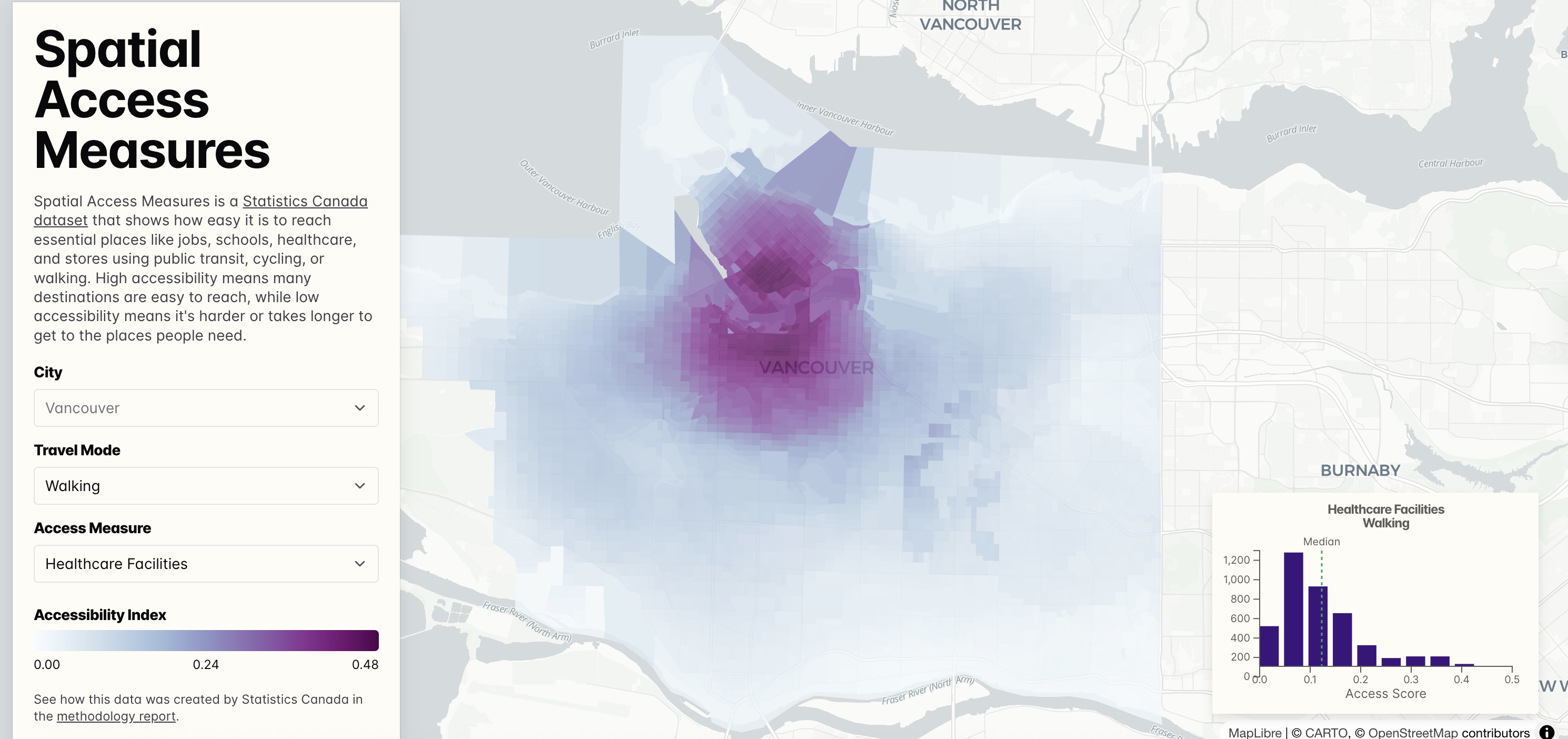
The Spatial Access Measures application uses DuckDB-Wasm, Deck.GL, GeoArrow and GeoParquet for a performant, local-first application.
3. STAC Semantic Search
Ask questions. Get STAC results.
We built a natural language search interface for STAC Items using LLM embeddings and simple vector search. A demo is live with STAC Browser integration coming soon. This opens the door to more human-accessible search experiences — from “snowpack in April” to “Sentinel-2 cloudless scenes in Ethiopia.”
- Explore the Streamlit demo
- Our STAC browser fork experiment (we want to upstream it!)
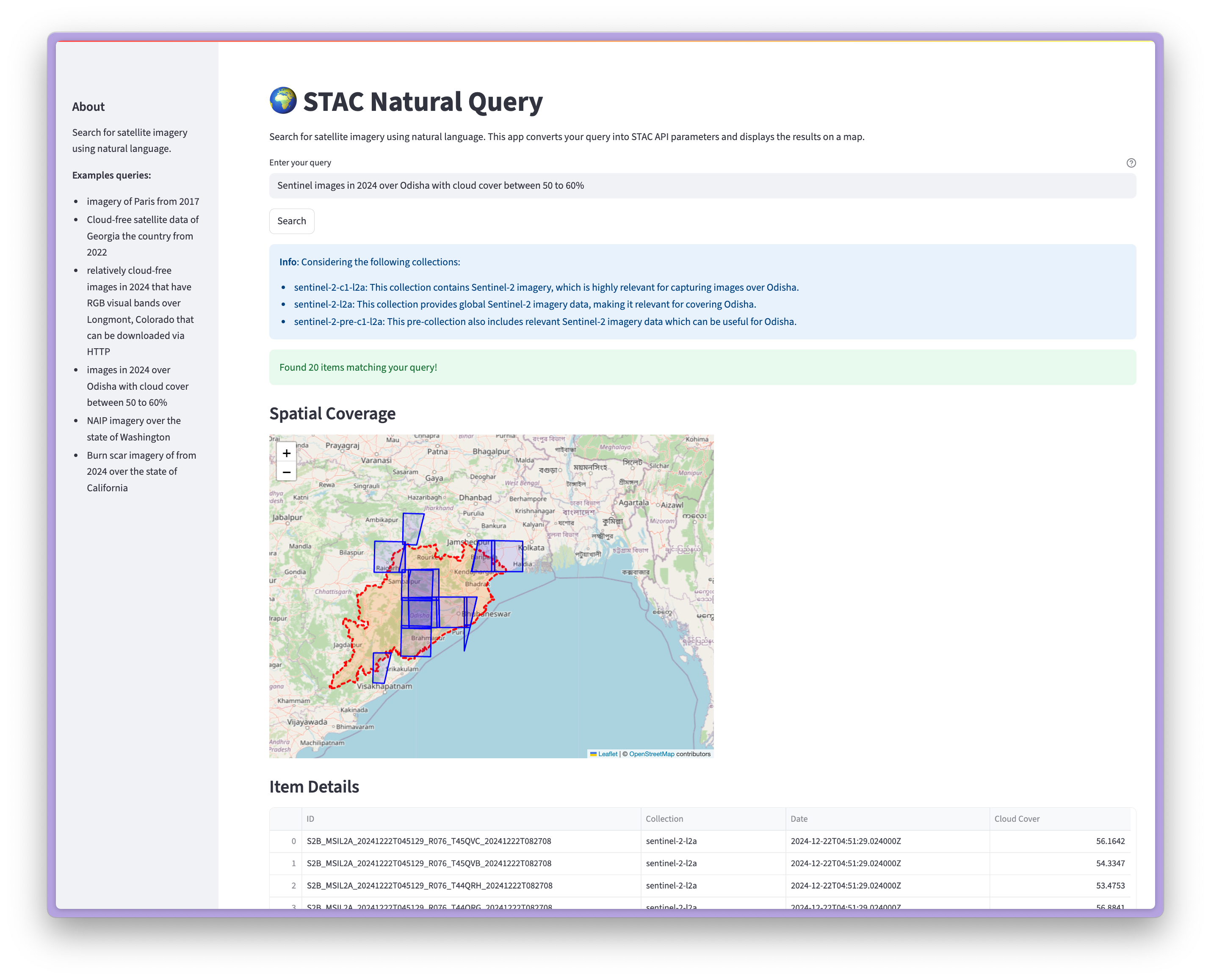
Use natural language to get STAC results.
4. Zarr visualization
We’ve been experimenting with visualizing multi-dimensional Zarr data directly in the browser — using standard web stack tools to create smooth, interactive previews for datasets like HRRR. This work builds on recent community momentum around cloud-optimized formats and aims to simplify exploratory analysis for atmospheric and climate data.
Check out our demo app.
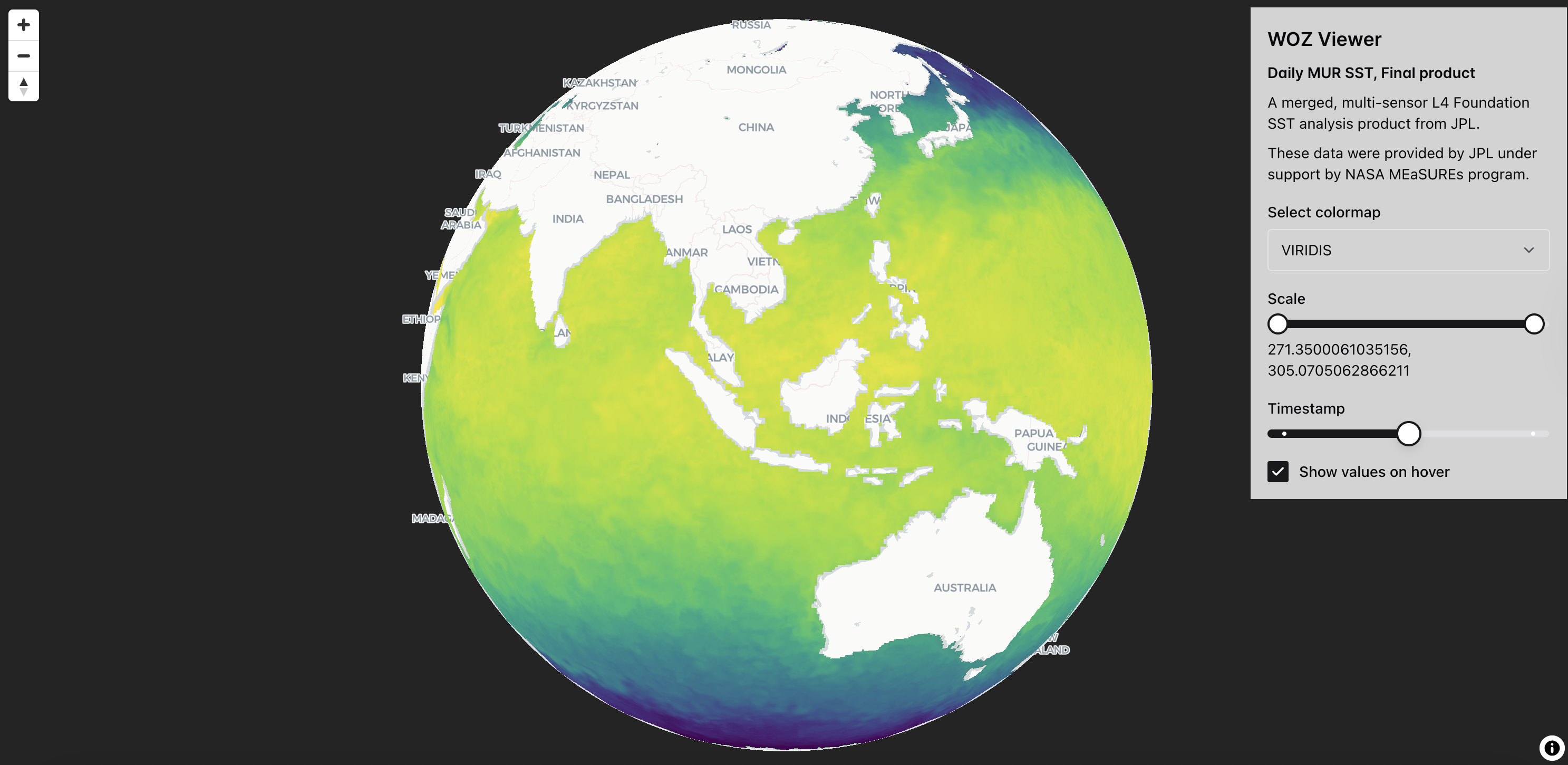
Easily visualize and explore multi-dimensional data with Zarr in the browser.
5. Dynamic STAC without the database, powered by GeoParquet
Fast, local queries over static STAC metadata.
Pete's been experimenting with how to use GeoParquet to enable fast search of STAC metadata — no Postgres required. We built a FastAPI-based prototype that can be bundled with static files and queried instantly, ideal for edge deployment or portable datasets.
This effort drove the creation of rustac, a new Rust library for working with STAC Items — which powers parsing and filtering in the API backend. It’s designed for reuse in high-performance or embedded contexts and may soon support even broader tooling.
python -m pip install 'stac-fastapi-geoparquet[serve]'
export STAC_FASTAPI_GEOPARQUET_HREF=path/to/naip.parquet
uvicorn stac_fastapi.geoparquet.main:app
Join the Fun
From building a playground for spatial filters in Rust, to rendering Zarr files in the browser, to experimenting with STAC metadata without a database — these projects are all riffs on the same theme: making geospatial data more usable, performant, and human-friendly.
None of these are finished products. They’re experiments born out of real needs, weird ideas, and collaborations. If something here sparks your interest — let us know. Better yet, fork a repo, open an issue, or try one out in the wild. Get in touch if you have an idea or a sticky problem. We're excited to see where these go next.
We're thrilled to share our ideas with you!
Related content
More for you
What we're doing.
Latest