


We're bringing open-source processing, collaborative visualization, and a hands-on LEGO installation to the ESA Living Planet Symposium 2025.

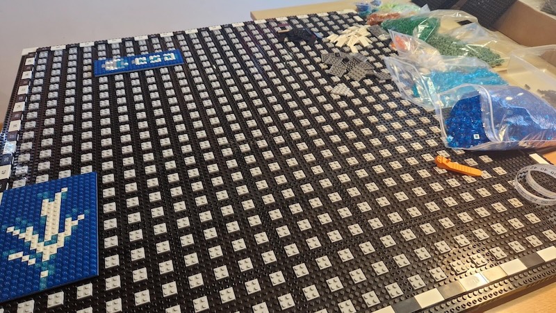
We're excited to announce a special interactive installation, where we'll build a giant pixel-accurate LEGO map of Europe – a physical version of Sentinel-2 imagery that conference attendees will create collaboratively, brick by brick, with the help of the latest open-source EO tooling.
Come and build with us at ESA's Living Planet Symposium 2025 in Vienna in June, at the Copernicus Data Space Ecosystem (CDSE) booth!
From Pixels to Bricks: Visualizing Earth Observation Data
This installation is a fun way to connect. It shows that Earth observation is a collective effort, supported by open-source tools, cloud technology, and common data standards.
Using Sentinel-2 imagery and open-source processing tools, we’ve translated real satellite data into a large-scale LEGO mosaic. As attendees place bricks throughout the week, the image will come into focus, just as EO projects come to life through shared effort and infrastructure.
The data pipeline that powers this installation is the same one we use across our Earth observation work. If you're curious about how satellite data becomes a physical object, we’ve published a technical explainer detailing the color mapping algorithms, openEO processing chain, and rendering workflow.
Loading up the Matrix
Build With Us
Stop by the CDSE booth anytime during the conference to contribute a brick and help assemble the mosaic.
Behind the Scenes: openEO by TiTiler
At the core of this build is openEO by TiTiler — a lightweight implementation of the openEO API that we developed in collaboration with Sinergise. It combines openEO’s standardized interface with the speed and flexibility of TiTiler, enabling real-time processing and visualization of satellite data.
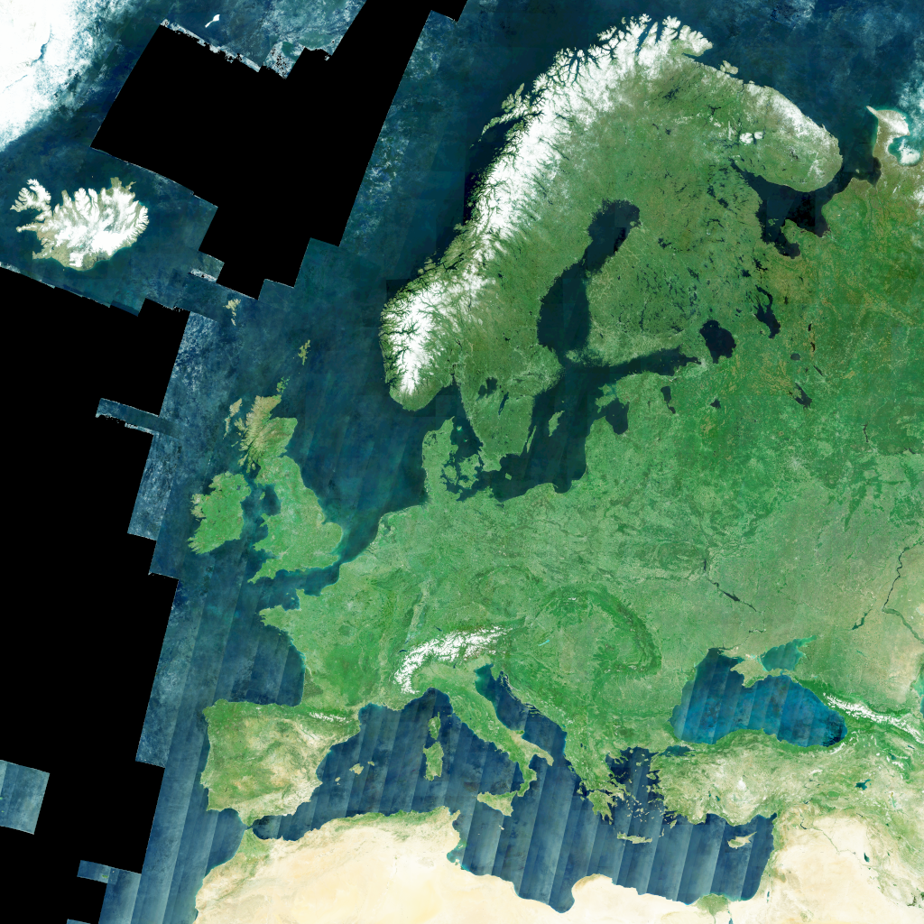
Curious about the technical process behind translating satellite data into LEGO bricks? Visit our detailed technical explainer to learn about the color mapping algorithms, openEO processing chain, and the science that makes this visualization possible.
Where to Find us
We’ll be participating throughout the week—presenting in sessions, sharing demonstrations, and co-hosting a community event. Here is the agenda of our contributions:
Monday 23 June
- 14:00-15:30: Session D.01.02 Technological Innovations for a Digital Twin of the Earth system, Daniel Wiesmann presenting Global Fish Tracking System (GFTS)
- 17:45-19:00: Evening Poster Session D.03.02 including our Overview of geospatial tools stack through Earth Observation API (eoAPI) by Jonas Sølvsteen
Tuesday 24 June
- 08:30-17:30: D.05.05: CDSE User Review Meeting - Olaf Veerman and Emmanuel Mathot representing Development Seed
- 17:45-19:00: Evening Poster Session D.03.04 including our Water Health Indicator System (WHIS) by Olaf Veerman and Daniel Wiesmann
Wednesday 25 June
- 08:30-09:45: Session F.02.03: International collaboration concerning satellite EO and Disaster Response - Emmanuel Mathot presenting "Montandon: The Global Crisis Data Bank")
- 17:00-19:00: Networking Event at Schweizerhaus with CNG, thriveGEO, EOX, and Radiant Earth - All team members
Thursday 26 June
- 14:00-15:30: Session D.05.03 Towards Modernized Copernicus Data, Brianna Pagán and Emmanuel Mathot presenting "Bridging the Gap: GeoZarr and STAC Integration"
- 11:15-11:35: Demonstration D.03.27 - EO Arena - openEO by TiTiler: Demonstrating Fast Open Science Processing for Dynamic Earth Observation Visualization by Emmanuel Mathot and Vincent Sarago
Friday 27 June
- 11:30-13:00: Session D.04.06 Advancements in cloud-native formats and APIs for efficient management and processing of Earth Observation data, co-chaired by Emmanuel Mathot
- 13:00-14:30: Lunch Poster Session D.04.06 including our Cloud-Optimized Geospatial Formats Guide by Emmanuel Mathot
- 14:30-16:00: Session D.04.01 Data Access and Interoperability to enable Infrastructure-agnostic Science Reproducibility, Vincent Sarago presenting Cloud-Native Raster Data: Revolutionizing Geospatial Analysis
Demonstrations
Throughout the week, you can find us at the Copernicus Data Space Ecosystem (CDSE) booth, where we’ll be showcasing:
- openEO by TiTiler: Fast Open Science Processing for EO Visualization
Interactive LEGO Installation
Visit the CDSE booth throughout the conference to contribute to our collaborative LEGO satellite imagery mosaic of Europe!
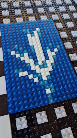
How we imagine this will look like
Let's connect
LPS25 brings together the EO community from across Europe and around the world. We’re looking forward to contributing through tools, ideas, and shared experiences. Whether you're interested in cloud-native data workflows or just want to help place a few bricks, come say hello.
You’ll find us at the CDSE booth, in the sessions above, and at the June 25 networking event. Let’s explore new ways of working with Earth observation—together, brick by brick.
What we're doing.
Latest