

The earth observation industry must bring data to decision-makers through applications that deliver proactive recommendations.

Earth observation has a scaling problem.
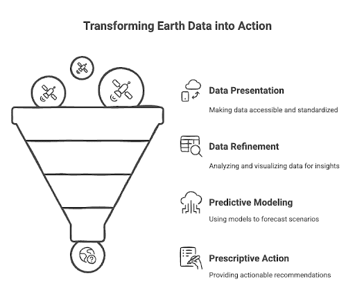
While the geospatial industry has mastered collecting massive amounts of satellite data, transforming this information into actionable insights for decision-makers remains challenging. We see this transformation as a journey.
It begins with making complex satellite data accessible and standardized through cloud-native approaches. As we refine this data, scientists discover patterns and anomalies that help us understand our changing planet. These insights enable us to predict future scenarios through sophisticated models and simulations. Ultimately, this journey leads us to prescriptive recommendations that help decision-makers take concrete action.
This four-stage progression — from presentation to refinement, prediction, and prescription — shapes our approach to building tools and platforms that make Earth observation data truly valuable for addressing our planet's most pressing challenges.
Here's how we're working to connecting steps in this journey.
Making Earth Data Accessible
The foundational value of Earth observation lies in how we organize and access data. This is the Present stage in the value journey.
Cloud-centric approaches have proven essential in transforming data into formats suitable for live streaming analysis at scale, ensuring cost-effectiveness, and developing consumer-facing applications based on these formats.
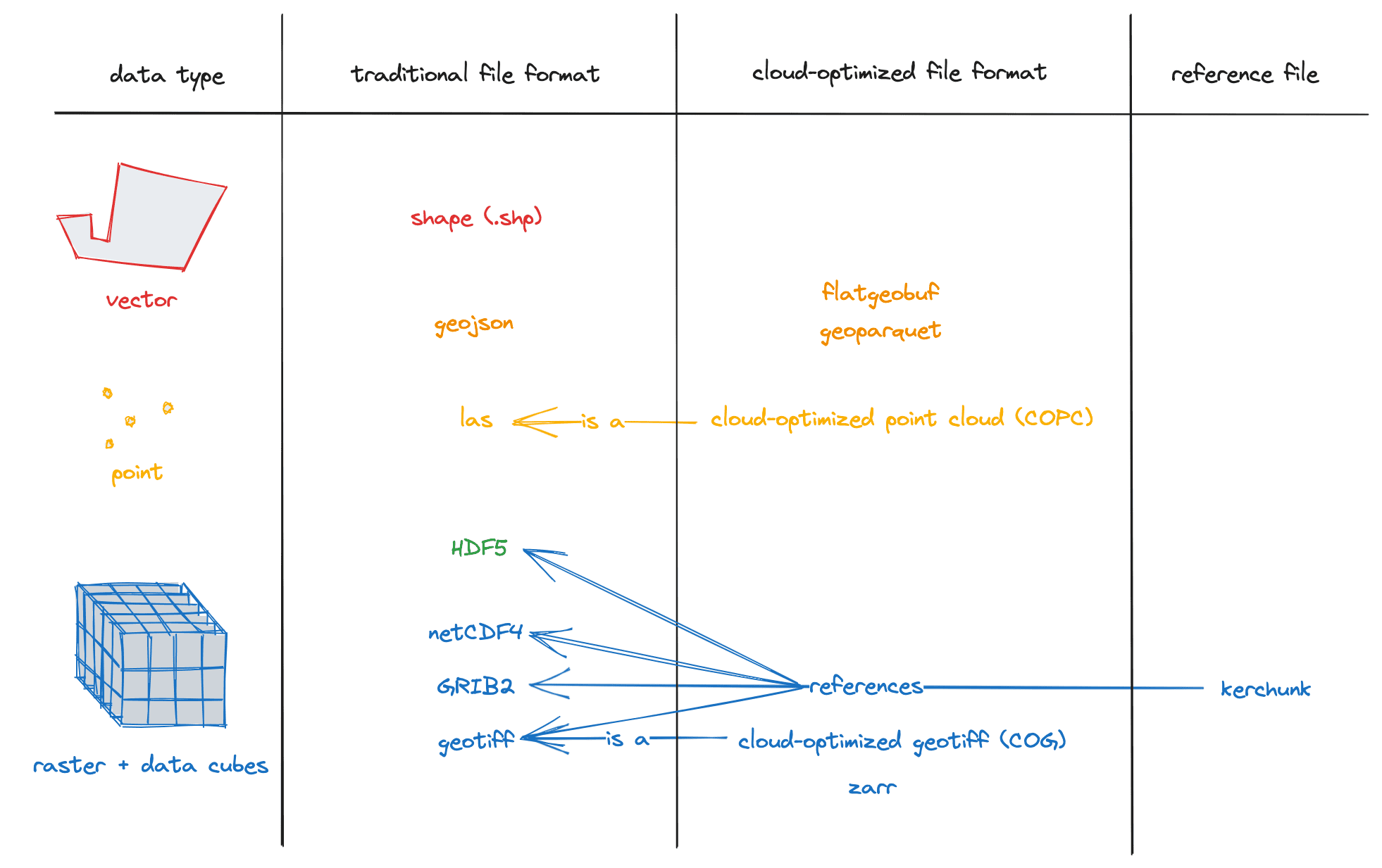
Cloud Native raster technologies, such as Cloud-Optimized Geotiffs, have improved compression and data access due to advancements in cloud storage. The parquet file format now includes a geospatial specification, highlighting its role in big data.
The rise of STAC (SpatioTemporal Asset Catalog) catalogs is enhancing metadata standardization and offering a more dynamic approach to organizing geospatial data. This makes it easier for users to discover and access data, improving compatibility and interoperability across systems.
Additionally, multi-dimensional cubes are evolving, with formats like Zarr and the xarray library enabling efficient storage and manipulation of multi-dimensional data in cloud environments.
Moving from geospatial-specific formats and tools toward geospatial adapters for widely adopted formats and tools
We're advancing this transformation through several key initiatives.
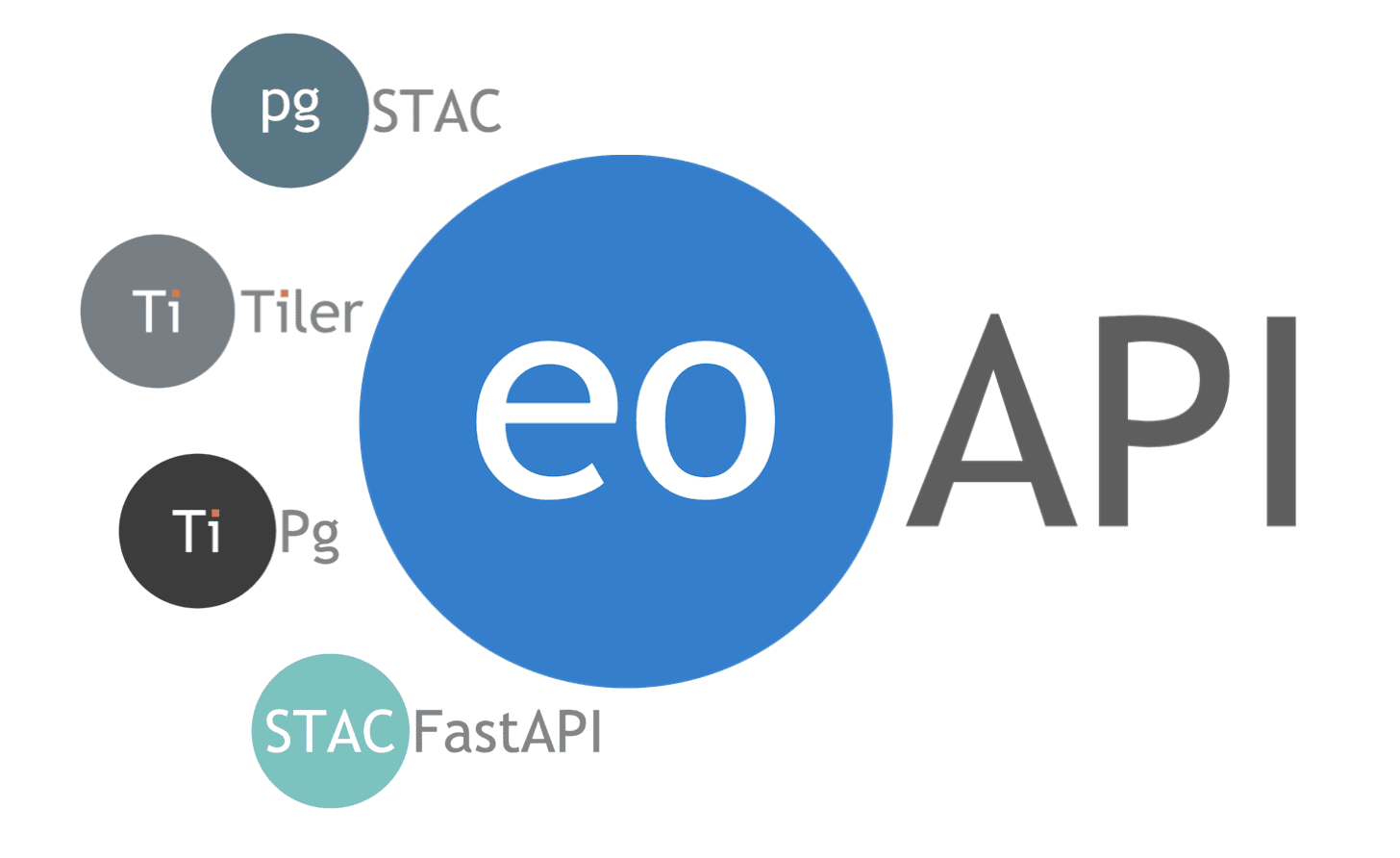
eoAPI makes massive earth observation (EO) data archives discoverable and interoperable—the fastest and easiest way to configure, customize, and deploy a full Earth Observation stack.
titiler.xarray
titiler.xarray enables dynamic tiling of multi-dimensional datasets, including traditional file formats such as NetCDF-4.
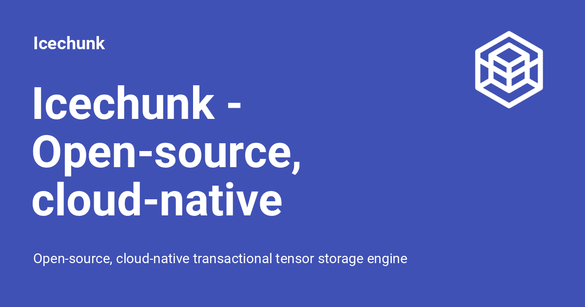
Icechunk
Icechunk, in collaboration with Earthmover and NASA, provides versioned storage for Zarr datasets, including easy access to archival data cubes.
Cloud-Optimized Geospatial Formats Guide presents methods for efficient data storage and retrieval.
From Data to Insight
With accessible data infrastructure in place, we're focused on enabling scientists to analyze and share their work effectively. Our approach combines cloud processing with intuitive visualization tools to refine raw data.
Unified Cloud Access
Our OpenEO by TiTiler project enables scientists to process data across multiple cloud providers such as AWS, Google Earth Engine, Microsoft Planetary Computer, or yet OVH Cloud without vendor lock-in. This ensures processing happens close to where data lives, improving performance and reducing costs.
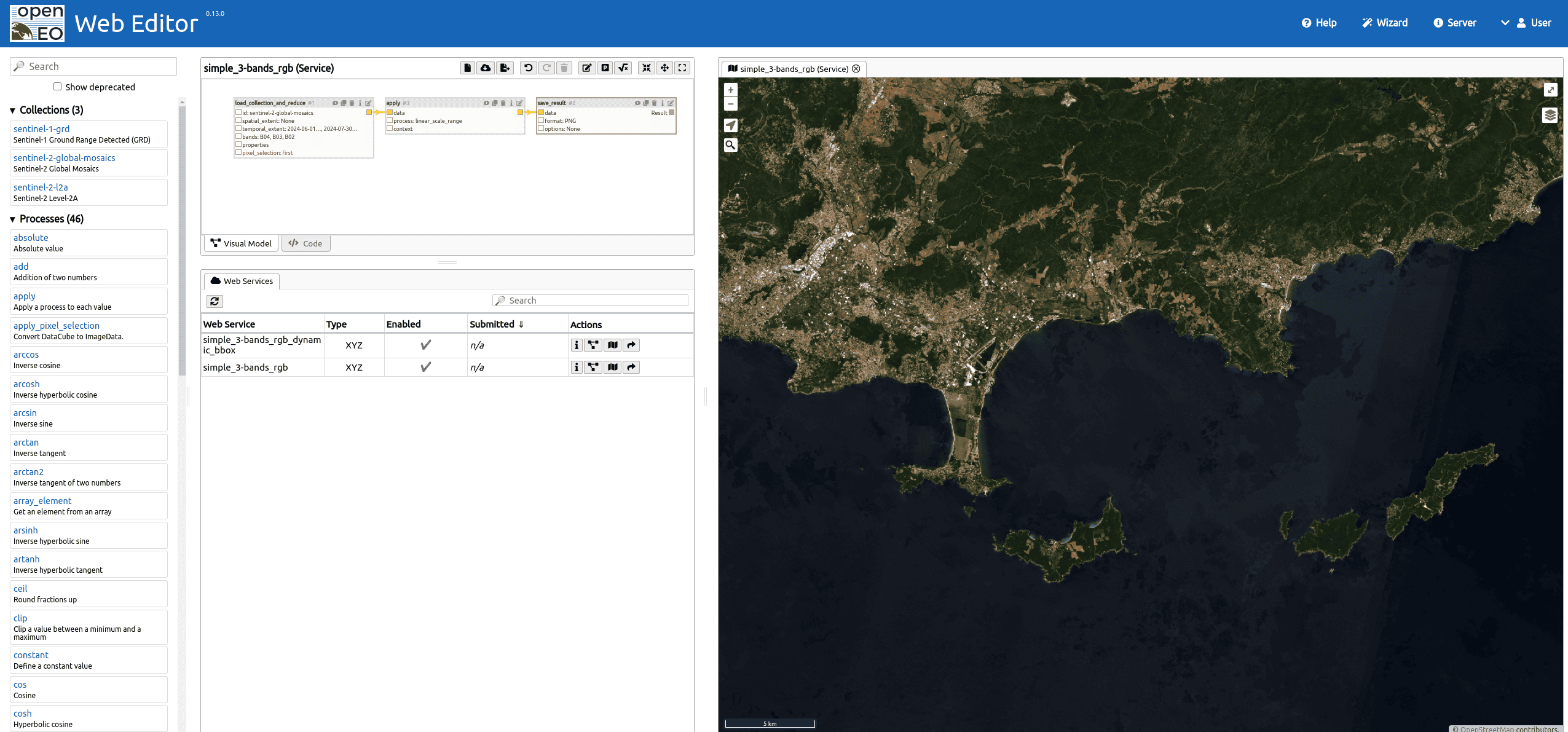
Light and fast backend for openEO using TiTiler engine.
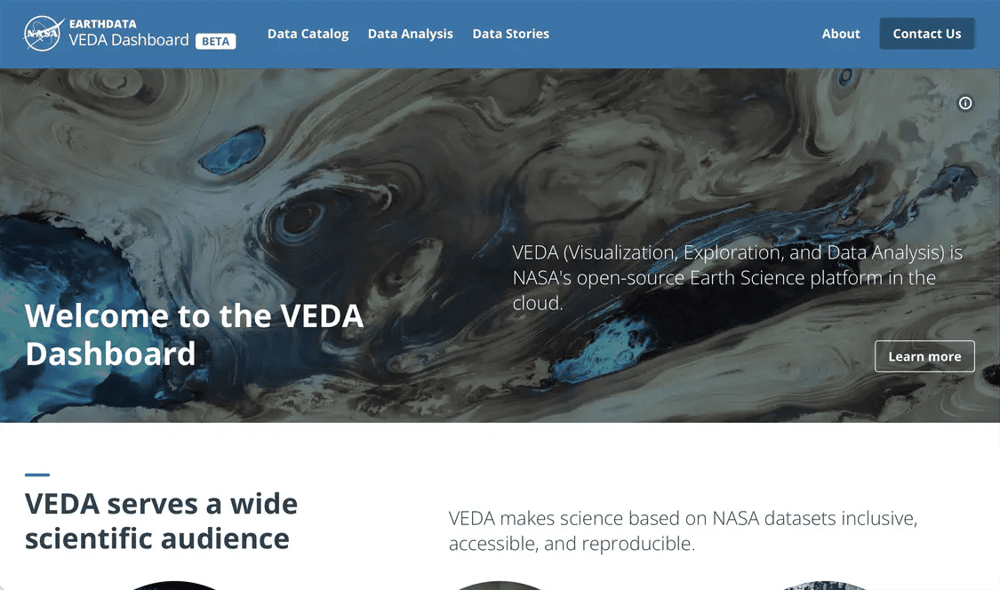
Interactive Visualization
Visualization tools, including VEDA and Lonboard, enable scientists to explore massive Earth observation datasets directly in their browsers. VEDA serves as NASA's cloud-native platform for collaborative analysis, while Lonboard leverages GPU-based rendering with GeoArrow and GeoParquet for high-performance visualization of large geospatial datasets.
Modeling Earth's Future
The most exciting developments in Earth observation combine traditional modeling with AI to improve our understanding of climate change and environmental challenges. We need to explore the effects of climate change on the different components of the Earth system using innovative Earth system models by simulating interactions & forecasting behavior. We're focusing on two complementary approaches
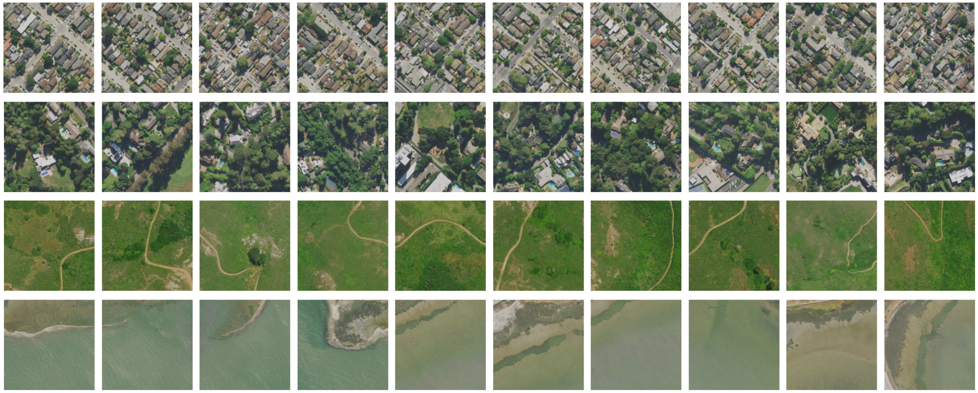
Foundation Models
In partnership with Clay, we've developed a foundation model that accelerates AI application development across different spatial resolutions and data sources. Our stac-embed tool (more on this soon!) combines this with STAC metadata querying for powerful similarity searches across image archives.
Digital Twins
The Destination Earth initiative demonstrates this approach in action. Their Climate Change Adaptation model offers multidecadal simulations, while the Weather-Induced Extremes twin provides high-resolution forecasts. A practical example is the Global Fish Tracking System, which combines climate data, sea temperature observations, and biologging to track sea bass behavior.
Turning Insight into Action
The final challenge is connecting these technological advances to real-world decision-making with actionable recommendations.
Through LLLLM, our suite of tools for using large language models, we're making complex spatial operations accessible through natural language interfaces.
This work combined with reinforcement learning and multi-agent modeling, enables sophisticated scenario planning for environmental applications, from transportation systems to policy design. While Earth observation data is already used operationally for mapping and status monitoring, its potential for forecasting and decision testing remains untapped. By focusing on model transparency, uncertainty characterization, and effective communication strategies, we're able to bring proactive recommendations directly to decision-makers, regardless of their expertise in Earth observation.
Bring proactive recommendations directly to non-EO experts
Looking Forward
Our work across these different initiatives reflects the essential stages of the Earth data value journey. Our cloud-native infrastructure and tools like eoAPI are crucial for the presentation stage, transforming raw satellite data into accessible, standardized formats that form the foundation for everything that follows.
The refinement stage comes to life through platforms like VEDA and Lonboard, where scientists can discover patterns and analyze anomalies in massive datasets. These tools don't just visualize data—they enable the deep analysis needed to understand our changing planet.
We're advancing the prediction stage through our work with Clay's foundation models and initiatives like Destination Earth. These sophisticated modeling approaches help us simulate future scenarios and accurately forecast environmental changes.
Finally, prescription-focused tools like LLLLM and reinforcement learning applications demonstrate where Earth observation insights become actionable recommendations for decision-makers.
While the technical infrastructure for collecting and processing satellite data has matured, the real challenge lies in completing this journey from raw data to meaningful action. By building tools and platforms that support each stage of the process, we're working to ensure Earth observation data can effectively address our planet's most pressing challenges.
If you have a particularly sticky challenge, we’d love to chat about it. Get in touch.
What we're doing.
Latest