


Earth Observation (EO) data is hard. The volume of data is growing at a pace that challenges traditional modes of access and analysis. Computational demands and heterogeneous data formats create bottlenecks, making it difficult to extract valuable insights efficiently.
We are committed to helping organizations around the world solve the most pressing challenges affecting people today with EO data. To achieve this, we are developing new open standards, open-source tools, and workflows to help developers build models, applications, and decision-making infrastructure.
Last year, we announced eoAPI, a modern, cloud-native framework for EO data management. It is a set of software packages that rely on standards like Spatio Temporal Asset Catalog (STAC) to manage massive EO datasets for analysis and applications. Platforms built with eoAPI now manage over a billion STAC items, making them findable, accessible, interoperable, and reusable (FAIR).
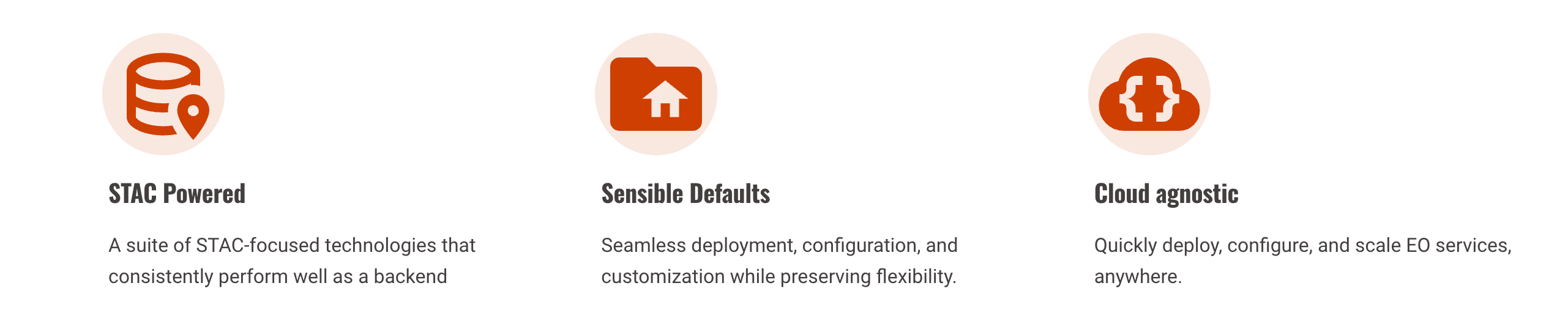
We know that no single tool or workflow fits all use cases. We intentionally built eoAPI as a collection of configurable components to fit your unique data ecosystem. eoAPI can be used with raster or vector data or both simultaneously. It can serve solely as a catalog for discovery or be combined with powerful tools to deliver data directly for analysis. It can run on a single computer or be deployed on any cloud provider. But no matter which components you use, we've made deployment, configuration, and customization easy by employing intelligent defaults based on real-world projects where we have tried and tested eoAPI.
Platforms built with eoAPI now manage over a billion STAC items
Building blocks for engineers
The modern EO stack has a few main components — data catalog, search and discovery, query and data delivery, visualization, and infrastructure management. The foundation of cloud-native geospatial is open specifications and standards established by the community like STAC and Cloud-Optimized GeoTIFFs (COGs). eoAPI consolidates these components with tools built on open standards. These tools can be integrated seamlessly. eoAPI has three key differentiators that allow engineering teams to deploy their EO stack rapidly:
- Define sensible defaults based on our past experiences to limit the number of decisions needed to get started using the components. For example, through implementations like PgSTAC, eoAPI makes helpful database and STAC interface choices.
- Effortlessly deploy and manage eoAPI on any cloud environment with infrastructure-as-code solutions using Kubernetes and AWS CDK.
- Plug-and-play services for all components within a common repository.
These building blocks enable teams to focus on building their use cases on top of eoAPI instead of building the entire stack from scratch. Let’s take a look at how eoAPI approaches STAC catalogs and tiling:
Scalable STAC Catalog
eoAPI provides a straightforward way to deploy a STAC catalog that can scale dramatically. STAC defines how we browse imagery (and now vector data) by space, time, and other attributes like cloud cover. eoAPI ships with the open-source project PgSTAC, a STAC extension for PostgreSQL databases. The extension provides convenient methods to create, search, query, update, and delete STAC collections and items through the Python library PyPgSTAC. The catalog can be integrated with any application using stac-fastapi, a FastAPI-based STAC API implementation that powers some of the largest open geospatial data catalogs.
Dynamic Tiling
Building a searchable catalog is only part of the puzzle. Most geospatial users need a way to access relevant data slices for analysis and visualization. Through ecosystems like Jupyter, the browser is becoming the default analysis environment alongside desktop tools like QGIS. eoAPI provides highly performant services based on TiTiler for raster and TiPg for vector tiling. TiTiler can serve tiles on demand from a COG. TiPg relies on the OGC Features API specification to serve vector data, making it incredibly easy to pull data into analysis tools. Both can connect directly to a PgSTAC database and create tiles in seconds. eoAPI also comes with TiTiler-PgSTAC, which can create and serve mosaics based on a STAC search query. Compared to the traditional static tiling approach, dynamic tiling has a drastically lower memory and compute footprint.

With dynamic tiling, EO data in the catalog can be used to its full potential:
-
Reprojection and rescaling: Different users and analysis workflows need data in different projections and scales. Using TiTiler, it’s trivial to reproject and rescale the data in the API request on the fly.
-
Band selection and arithmetic: One or more bands can be selected from the data, delivering exactly what the analysis requires. eoAPI also makes it possible to instantly perform arithmetic operations on the bands, like calculating NDVI for only the required area.
-
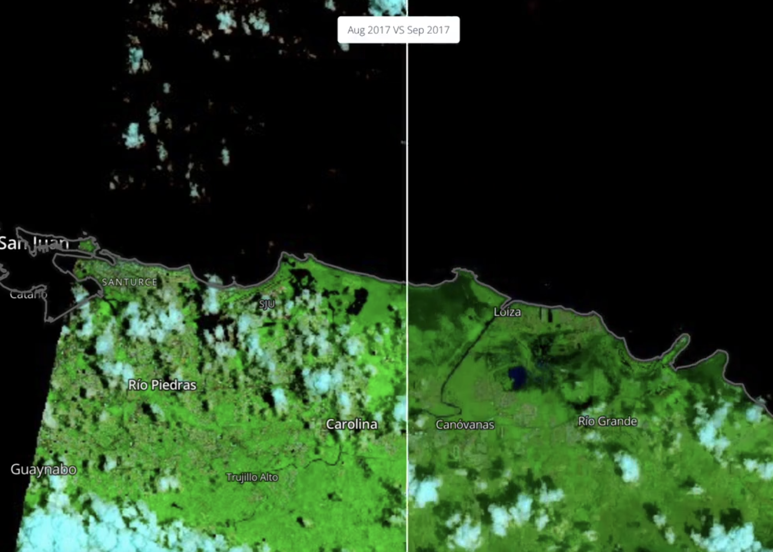
Custom processing and color maps: applications that require custom algorithms to be run on the EO data benefit significantly from real-time tiling. Using the BaseAlgorithm class, it’s easy to add a flood detection method. eoAPI supports many default colormaps and can be customized for accurate data visualizations.
Combined, these tools can be used to build applications that search, discover, and access petabytes of data from a multitude of datasets.
Built for customization and collaboration
For many organizations, EO infrastructure is transforming into a central hub for a diverse ecosystem of tools and applications. It must be designed to meet the needs of a broad range of user groups, scenarios, and application demands. From data pipelines to defining your permission models and even designing the right user experience for your use case, eoAPI seeks to provide versatile building blocks that can be adapted to your specific context. This modular architecture ensures that everyone from GIS professionals to remote sensing engineers, data scientists, and application developers can effectively interact with Earth observation data through their tool of choice.
We provide examples and support for organizations to implement authentication, authorization, ETLs, and notification services tailored to their needs. Although based on eoAPI, solutions like NASA's VEDA (Visualization, Exploration, and Data Analysis) and the Amazon Sustainable Data Initiative have distinct user experiences optimized for their targeted audiences. This is why we are building tools like stac-react and stac-admin, as the foundation of custom STAC frontends.
EO infrastructure is becoming the central hub for ecosystems of tools and applications.
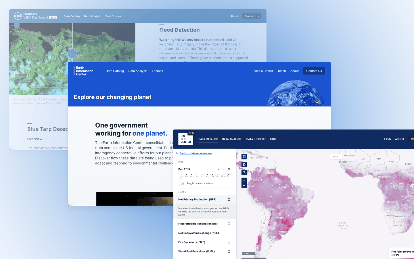
The newly launched Earth Information Center catalog, the US Greenhouse Gas Center and NASA's VEDA platform are all powered by eoAPI.
Empowering key decision-makers
eoAPI is made possible by our partnership with NASA’s Interagency Implementation and Advanced Concepts Team (IMPACT), with core components such as pgSTAC developed in partnership with Amazon Sustainable Data Initiative and organizations building global environment data platforms. NASA’s VEDA open-source Earth science ecosystem is entirely built on eoAPI. The recently released Earth Information Center, created by NASA in collaboration with EPA, FEMA, NASA, NOAA, USAID, USDA, and USGS, relies on eoAPI, allowing easy access and analysis of key datasets. The German Aerospace Center (DLR) uses eoAPI on its Terrabyte platform to empower internal researchers. Natural Capital Exchange (NCX) uses eoAPI to drive its community of landowners and property developers.
With eoAPI, we are enabling our partners to make better decisions based on planetary insights. eoAPI is used at scale, but you can get started in minutes. If you want to learn more about how eoAPI can help your data delivery and analysis workflows, get in touch.
What we're doing.
Latest