

OpenAerialMap is growing. UAV operators around the world are making their imagery open and available. The latest imagery available in OAM is post-disaster imagery after Typhoons Haiyan and Ruby. Typhoon Haiyan, also known as Yolanda, struck the Philippines in November 2013 killing more than 6,000 and left 4 million displaced from their homes. The Philippines was still recovering from Yolanda when Typhoon Ruby struck a year later. Disaster response organizations in the Philippines used imagery after typhoons to assess building damage. The new imagery was collected as a part of disaster response activities by Philippines UAV companies Skyeye Inc. and COREPHIL Data Services.
Aerial imagery after a disaster is a critical response tool. Imagery after these Typhoons and after the recent earthquake in Nepal was immediately helpful for creating maps to aid response efforts. Aerial imagery is used to measure the extent of the devastation, the locations of displaced people, and what existing infrastructure exists to support the response.
Head over to OpenAerialMap and hit “Browse latest imagery” to check out the new imagery. Thanks to Maning Sambale for helping to import the imagery into OpenAerialMap. Also check out OpenAerialMap’s slick new imagery filtering and sorting features.
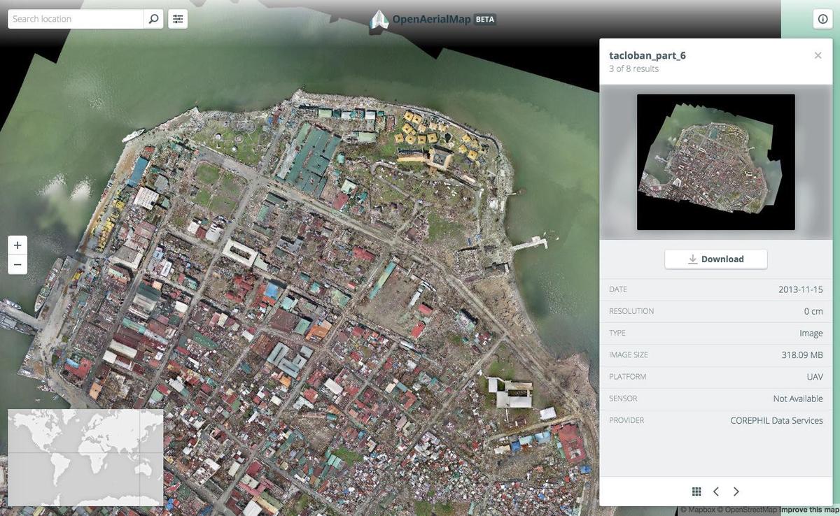 Imagery over Tacloban after Typhoon Yolanda, December 2013
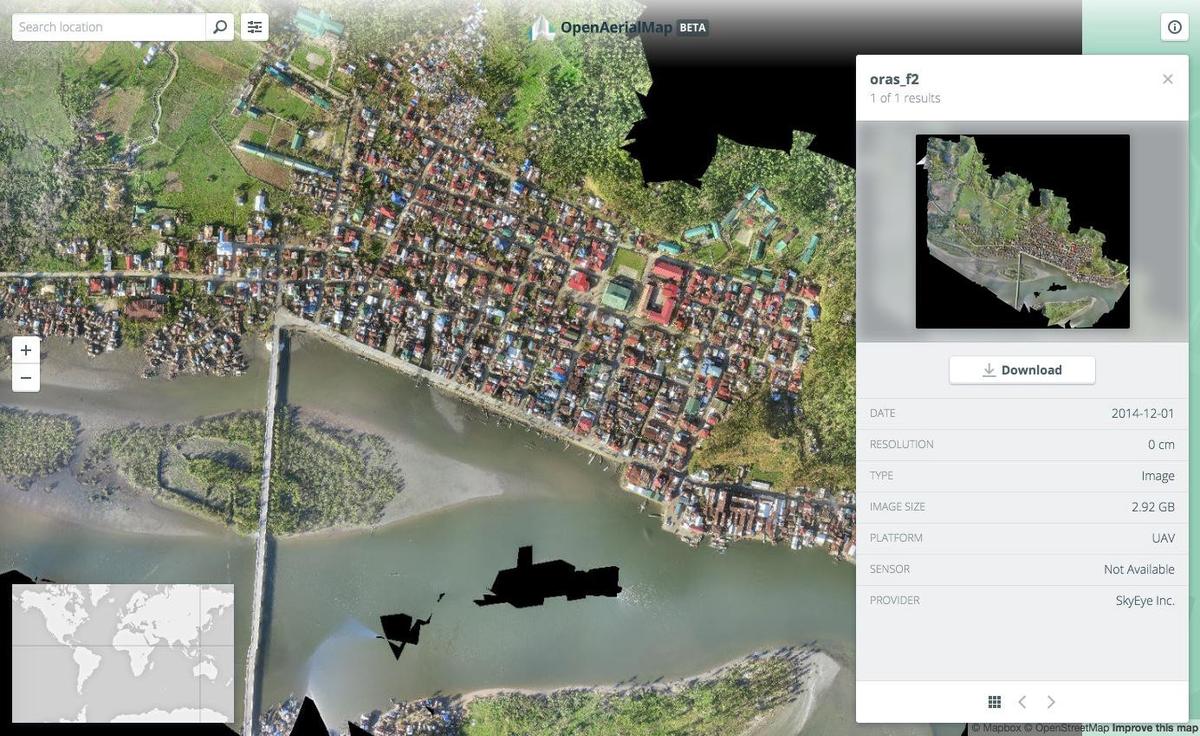 Imagery over Oras after Typhoon Ruby, December 2014
What we're doing.
Latest