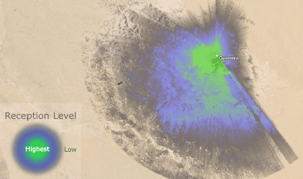
Geography matters a lot to how far radio signals carry. We recently worked with DigitalGlobe to map the reach of radio signals.

To determine the extent of radio influence on populations, DigitalGlobe GIS developers produced a geospatial model based on the Longley-Rice Irregular Terrain Model of radio propagation. The model uses terrain feature and radio measurement inputs to predict radio signal reduction.
These inputs are brought to life when the output raster is styled in TileMill to reveal the dramatic change in reception levels around real-world terrain features.
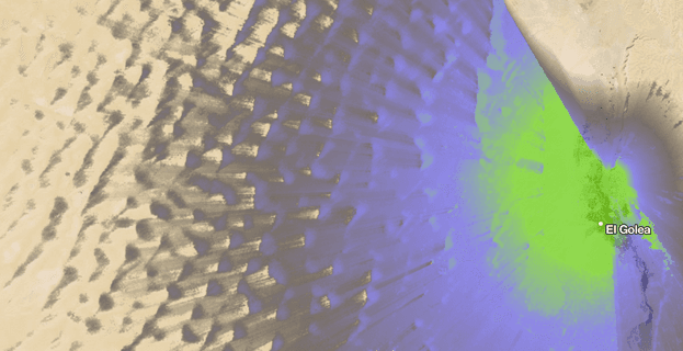
Here you can see how radio signals decay as they interfere with sand dunes:

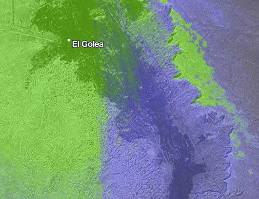
Here is a close up of abrupt changes in signal strength around a mountain peak:

We can imagine a lot of other ways to use radio propagation modeling. Emergency preparedness and response efforts need to project radio coverage to identify dark spots. Using radio propagation maps overlaid on voter registration data, citizen groups can plan more effective voter outreach efforts. The Longley-Rice Model works for frequencies from 20MHz to 20GHz. Community wireless efforts could apply similar modeling methods to plan the deployment of wifi (2.4GHz) nodes.
What we're doing.
Latest