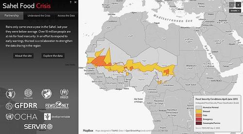
This afternoon at The Resilience Dialogue: Preparing for a Changing World and together with the Global Facility for Disaster Risk Reduction (GFDRR), we are launching SahelResponse.org — a data sharing portal that opens and visualizes critical information about the growing food crisis in the Sahel region of west Africa.

The site is a tool to visualize and share key regional datasets
The site brings together datasets about changing weather and drought conditions, visualizes regional conflict, and shows areas of extreme risk for food insecurity. In all, the site opens up 46 datasets for public and humanitarian use from regional and international organizations working in emergency relief and long term development in the Sahel region, focusing on the critical countries of Mauritania, Mali, Burkina Faso, Niger, and Chad. All datasets are released to the public domain making them a highly valuable asset for analyzing risk for anybody from individuals to NGOs and local businesses. UNOCHA limits use to humanitarian applications. Here is a just over a minute walkthrough showing how the site works:
Facilitating data sharing between organizations
The food crisis in the Sahel is worsening and it’s estimated that over 15 million people in the region are at risk of food insecurity. As we mentioned in the blog post on MapBox’s OpenStreetMap tracing efforts in the Sahel, having a common operating picture is critical for responding to early warnings about a crisis.
For the first time in the region, the site brings together key datasets in one place to improve situational understanding and provide raw data downloads for further analysis. Early coordination among regional and international actors is needed for an effective and sustainable response. The site was developed as a platform for the partnership convened by the World Bank and the Global Facility for Disaster Risk Reduction (GFDRR) with the World Food Programme (WFP), UN Office for the Coordination of Humanitarian Affairs (UN OCHA), UN High Commissioner for Refugees (UNHCR), Information Technology for Humanitarian Assistance, Cooperation and Action (ITHACA), Famine Early Warning System Network (FEWS NET), NASA/USAID SERVIR project, and Development Seed.

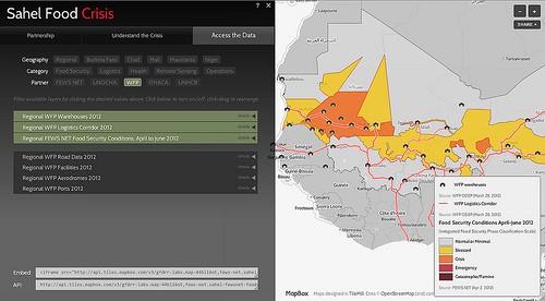
Site includes operational and logistical data about providing emergency food assistance to the region
This site leverages a simple HTML and Javascript framework and MapBox Hosting to provide a fast platform to decentralize data sharing and keep ownership of the data within each organization. This reduces maintenance requirements for the central site and allows organizations to easily publish updates to their data. Using filters and layer switching functionality, the site allows users to quickly browse through all available datasets, visualize any combination, and download the raw data for further use. In addition, embed and API functionality is integrated into the site to allow users to republish the maps on their own site or within an internal application.
We’re excited to see openness and public sharing of data discussed as a critical aspect of building resilience. We look forward to continuing to contribute to the project and improve data sharing in critical areas.
What we're doing.
Latest
