Today we’re releasing World Bright, a new world map tileset publicly available MapBox.com.
Some data © OSM CC-BY-SA
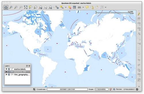
World Bright has a lot in common with our other world map tilesets, but includes some additional data layers and unique styling. The biggest new feature is a custom labels layer of water bodies. Based on data from Natural Earth, the layer is a collection of points and curved lines that, when styled appropriately, allow for big, curved marine feature labels in a classic cartographic style. Creating these lines was very much a manual process in QuantumGIS:

Not all of the features from the Natural Earth marine areas dataset are included, but we tried to make sure most of the major ones made it into World Bright.
We’ve also included subtly-shaded populated areas from Natural Earth, in addition to the coastline, administrative boundaries, and place labels familiar from World Light and our other world maps.
For more information on how you can integrate the World Bright tileset and other MapBox maps into your website with popular JavaScript web mapping APIs, check out Tom’s recent post about Wax. You can use our hosted version for free, or download the MBTiles file to use it offline.
What we're doing.
Latest