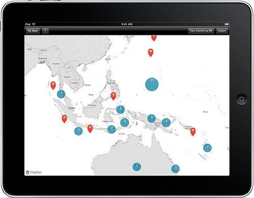
The MapBox App for iPad is now available in the App Store for free! The app lets you download and interact with custom map tiles from MapBox.com and visualize KML and GeoRSS data. Everything is stored directly on the iPad so you can use the app without an internet connection.

Here are some of its top features:
-
Super fast offline maps
-
Use iTunes to load KML or KMZ files from Google Earth or other sources
-
Save snapshots of GeoRSS feeds for offline display; subscription support is in the works
-
Visualize large data sets. MapBox can automatically cluster points for you to help better visualize large data sets.
-
Replace the default base layer with free tilesets from MapBox.com
-
Use the OpenStreetMap layer when an internet connection is available
-
Save your map views and load them again later
-
Share snapshots of your maps via email
This application is built with open source tools. We used existing projects like route-me for the map view, and released new open source projects like SimpleKML for KML parsing. In a few days, we’ll release the Cocoa library that allows you to use MBTiles files as layers in route-me. This will make it easier for all iOS developers to use the MBTiles format and custom map tiles in their own apps.
We see version 1.0 of the MapBox app as a platform to drive more highly custom mapping applications on iOS. We’re working on adding more excellent features to upcoming versions. At the top of our list is adding a VGA presentation mode, live GeoRSS sync, and legend support for overlays.
And finally, this spring you’ll be able to use MapBox.com to design your own custom tiles for use on the iPad. Here’s a peek at the new tile editor we are developing (think WYSIWYG for shapefiles).
What we're doing.
Latest
