UPDATE: We no longer maintain the dataset discussed in this post, but it is still available for download from CGIAR.
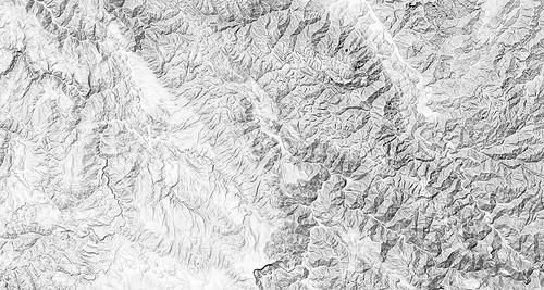
We’ve processed the complete world elevation SRTM 90m dataset from NASA’s Shuttle Radar Topography Mission into an Amazon EBS. This SRTM data provides both high resolution and worldwide coverage of raw data that we use to make the hillshade components of our maps, like the — terrain context for our Haiti tiles and like this map of Ayacucho, Peru.

Having the SRTM data as an EBS means that rendering a world map, including 80% of the globe with all the benefits of CGIAR’s processing, can be achieved by creating an EBS volume in seconds and attaching it to a cloud computer. We did this because it will save us time when rendering maps. Before, the process was quite a bit trickier — browsing and downloading the data individually is tricky to do and nearly impossible to automate. And the important and delicate steps of merging and re-projecting the data not only take processing time but also a significant amount of learning and setup to get going.
Using the SRTM EBS
This is a very large dataset — in total the volume is 600GB — containing about 350GB of raw data, so it is recommended that users create an extract of the data for the specific area they plan to render. The gdal_translate utility can perform this task, and the documentation included gives a quick example. You can create an instance by specifying the snapshot id snap-1861c070 in the Amazon AWS tools or control panel.
Open data
Along with the data, the disk image includes licensing information and a detailed account of how users can do the same processing to the data from start to finish. The data is distributed under the original license terms, so it’s free to intermix with other free data under the condition of attribution.
A big thanks to Andy Jarvis from the International Centre for Tropical Agriculture (CIAT) for giving us the thumbs up to share this EBS publicly.
Why we like SRTM data
After evaluating many sources of elevation data for our recent mapping projects including custom maps of Iraq and Afghanistan, we determined that the CGIAR dataset is the best option for open data, and one of the best for data of any license. Higher-resolution data like the USGS elevation models are available for smaller areas of the world, but CGIAR excels in resolution, coverage, and processing. Unprocessed SRTM data is available but shows the flaws of the technique — one will often see areas in which data is completely absent because of radar scatter. This means that interrupting mountain ranges and other beautiful surface features are areas which are essentially at ground level or unknown. The CGIAR dataset has these areas detected and filled in with other datasets or by mathematical approximation, thus making the dataset far more usable for visualization and analysis.
What we're doing.
Latest