Headed to Haiti to Conduct Training and Outreach on OpenStreetMap
- Estimated
- 3 min read
This Sunday I will travel to Port-au-Prince as part of the Humanitarian OpenStreetMap Team to build upon the work done by the OpenStreetMap community to expand maps of Haiti in response to the earthquake. Immediately after the January 12 quake, Google opened up its GeoEye imagery and hundreds of people pitched in to trace and add the data to OpenStreetMap, quickly building the best dataset available for Port-au-Prince and the surrounding areas.
On this trip we’ll partner with UN agencies, local and international NGOs, and the Haitian government to work towards making sure that these maps are sustainable, that we have local participation and ownership, and that responders from the international community are well prepared to take advantage of what OpenStreetMap can provide in their future deployments. I’ll be traveling with Nicolas Chavent, whose energy and connections will be essential to making the three week mission a success.
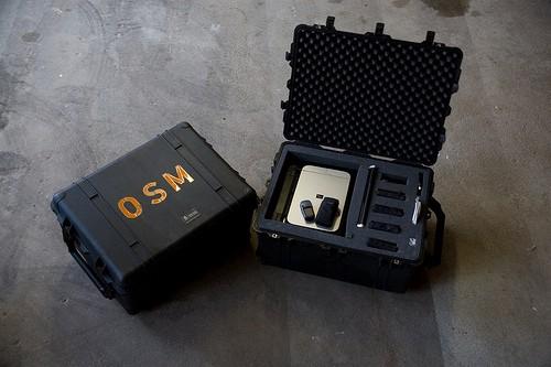
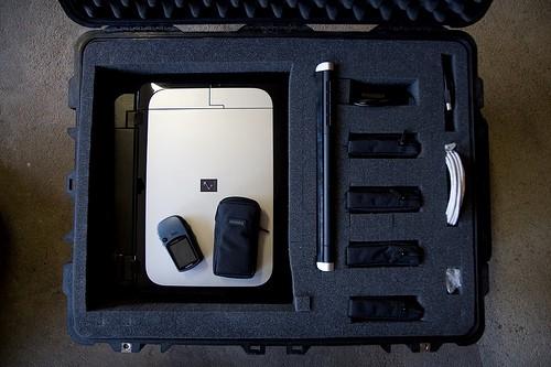
The preparations for the trip have been intense. On top of planning meetings with Nicolas and other partners, I’ve been buying a lot of hardware we’ll need on the ground, prepping laptops with a variety of software and data, and working with Tom and AJ to update Haiti map tiles and load up Maps on a Stick on usb drives and hard drive so it’s ready to travel with me. Schuyler Erle’s packing list has helped me not have to think about what to bring for myself, so I’ve been focusing on how to get two pelican cases loaded with laptops, all-in-one printers, GPS’s, USBs, cameras, and a variety of cables, cords, batteries, and other miscellany that will let us operate independently and offline during our time in Haiti.


Along with the training and outreach we’ll do on the ground, I hope to come away from this mission with concrete ideas on how we can improve the tools and data available to responders looking to use OpenStreetMap in their work. Nicolas has already begun implementing the Humanitarian Data Model for JOSM, which relies on concepts from UN Spatial Data Infrastructure for Transportation (UNSDI-T) that he was the core author of, and there are a number of other suggestions on the Humanitarian OpenStreetMap Team wiki page that I hope we’ll be able to refine and prioritize after learning more about what’s needed.
We’re lucky to have the support of NGO and UN staff currently working in Haiti, the advice and expertise of MapAction, and some great insights from Tom Buckley and Schuyler following their World Bank-supported mission in February that will all help us make this trip a success. During the trip, we’ll work closely with Chris Phillips of MapAction and also with Tom who’s second deployment to Haiti will overlap in part with our stay. This work is supported by the European Commission Humanitarian Aid Department, facilitated by MapAction and the United Nations, and largely made possible due to the tremendous amount of work done by Mikel Maron and Nicolas explaining in what ways OpenStreetMaps can be used in humanitarian situations like this. For more information about the project, check out this blog post written by Mikel on Wednesday and the project proposal.
I will be posting updates on our work when I can (you can follow me on twitter @rsoden), and Nicolas and I look forward to sharing the full details of the trip and our progress when we return.
What we're doing.
Latest