
Maki Icons: Point of Interest Icon Designed to be Versatile and Descriptive
- Estimated
- 2 min read
UPDATE: We’re moving fast and the documentation discussed on this page is out of date. Check out our newer blog post on the new maki icon set instead.
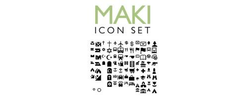
I just finished the final adjustments to the 85 icons that make up the Maki icon set and have committed them to GitHub.
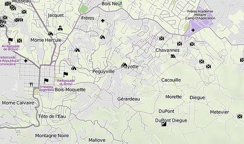
AJ had started these after needing a few specific symbols for an internal custom map. After the earthquake in Haiti, we quickly needed good icons to represent things like landslides and collapsed buildings, so the icon set grew. At this point we already had 20 to 30 icons, so we decided to clean up the existing icons, fill in the gaps, and release the set publicly. Now MapBox users (and for that matter everyone else) will be able to use these icons in their own projects. Here’s a look at them in use on a map of Haiti.
There are three key parts to this release:
Hot linking ok!: All icons are cut and stored on the MapBox Amazon space, so you can hotlink to the icons. We did this to make it as easy as possible to add the icons to your site.
Raw source files: The icons are all available in SVG format on git. They are licensed under BSD, so feel free to modify, expand on, and even resell them. If you use Inkscape, the icons are grouped and named to take advantage of the program’s batch export feature.
Style guide: To make it easy for people to expand the set, we’ve published a style guide that explains our approach to designing Maki. The icons come in two sizes: 10 x 10 pixels and 15 x 15 pixels.
With Maki we aimed to create an icon set that is as complete as possible while being general enough that it can used in everything from commercial to disaster response maps. My design approach was to make icons that are as straightforward and recognizable as possible. Strong silhouettes of unique shapes help each icon stand out, yet a consistent approach to line weights and level of detail allows the set to look elegant in dense urban areas and on larger regional maps. As much as possible, I tried to develop non-culturally specific icons that are equally useful to Haitian disaster victims, African farmers, and American tourists. In order to meet this goal more fully, I encourage others to contribute to the set so it is more complete.
Here are some other good icons sets for maps:
What we're doing.
Latest