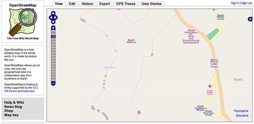
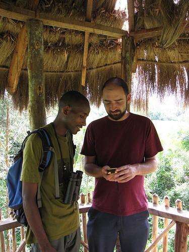
I spent the last few days working with a group of rural development specialists from UNITE and KAFRED in Bigodi, Uganda incorporating OpenStreetMap and Quantum GIS into their projects. The goal was to quickly identify a workflow and some best practices that would give them the greatest amount of flexibility with the lowest barriers to entry in terms of bandwidth requirements and complicated software to learn. This is just the start.

Bigodi is a village of about 400 people near Kibale National Park, which attracts numerous visitors hoping to get rare glimpses of wild chimps and stay in some of the region’s high-end resorts. Over the past decade, several small NGOs have begun working in Bigodi, hoping to take advantage of the area’s natural wealth and tourism industry to shape development in such a way that more directly benefits the residents. Electricity comes from either solar panels or gasoline generators, and there is one mobile internet connection in the village, allowing program staff reliable — if shared — access to the internet when necessary.
The majority of my time was spent with the staff of UNITE, a project funded by the North Carolina Zoo that does teacher training and environmental education in Bigote and the surrounding villages. I also interacted with a project called KAFRED (Kibale Association for Rural and Economic Development), a UNDP/GEF-funded community eco-tourism project that manages the Bigodi Wetland Sanctuary.
After some discussions, we decided that OpenStreetMap would be immediately useful in a number of ways. In the past project volunteers had collected data and made maps of the area with locations of schools and projects important to UNITE and KAFRED. However the volunteers moved on taking the data with them, and there was no way to update their maps to reflect changing conditions. Using OSM as a community data repository for basic information — schools, hospitals, land use, and tourism sites — about Bigodi and regularly downloading shapefiles from CloudMade provides a simple way for these groups to collectively create and store data that won’t disappear when staff moves on.
Traditional GIS software requires a great deal of training to use and offers functionality that is both over the head and beyond the needs of most new users. The projects I worked with really just wanted a solid basemap of the areas in which they operated and the ability to easily update the data or take it offline as necessary. We held a small mapping party where I was able to provide basic training in the use of GPS devices as well as uploading and editing data in OpenStreetMap. Participants quickly got the hang of things and we moved quickly past the technical training and into discussions about what we wanted to put on the map and what data we could collect that would be most useful.

We considered using Walking Papers but ran into a few challenges. Primarily, there wasn’t any data in OpenStreetMap for the area so we didn’t have much context to start with. UNITE is interested in exploring this further now that a simple basemap of the village has been more or less completed. This will also mean an hour drive or taxi ride into the nearest town, Fort Portal, or the purchase and maintenance of a printer and scanner for the project. This trip also would have been necessary had it not been for the shared subscription to mobile internet, something not present in all places that definitely made our process simpler.
With the staff of these organizations trained and a map of the village underway, there are a number of ways in which they are looking to move forward. The KAFRED guides that give tours of the Bigodi Wetland Sanctuary are very interested in learning the tools and working to complete the basemap of the village. UNITE is planning on working with some of the secondary school teachers to have a mapping party, using Walking Papers, and then strategize about how OpenStreetMap could be used as an educational tool with their students. There was also a lot of conversation about creating a regional tourist map that highlights community-based organizations to encourage tourists at Kibale to also visit some of the villages and learn about the community-oriented projects in the area.
What makes a lot of these ideas exciting is that using OpenStreetMap allows them to be accomplished without expensive software or extensive training. This also makes the projects more sustainable. I look forward to following the mapping progress and continuing to work with UNITE and KAFRED as they train more community members and find more ways to use OpenStreetMap to help their work.
What we're doing.
Latest