
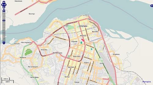
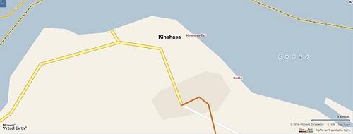
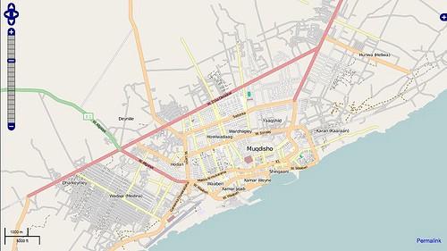
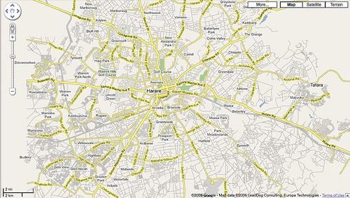
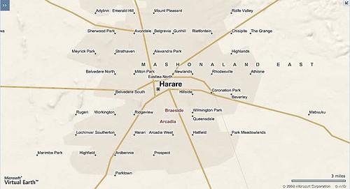
OpenStreetMap has better coverage in some niche spaces than other mapping tools, making it very attractive resource for international development organizations. Want proof? Inspired by this post, we looked at capital cities in several countries that have been in the news lately for ongoing humanitarian situations — Zimbabwe, Somalia, and the Democratic Republic of the Congo. For two our of the three, Mogadishu and Kinshasa, there is simply no contest — OpenStreetMap is way ahead of the others in both coverage and in the level of detail. OpenStreetMap and Google Maps are comparable in Harare. The data available through Microsoft’s Virtual Earth lagged way behind in all three. Check out the images below:
Kinshasa
OpenStreet Map
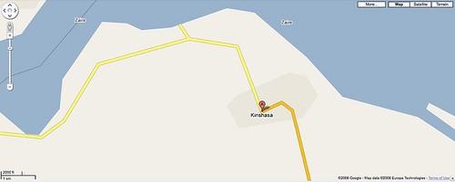
Microsoft Virtual Earth
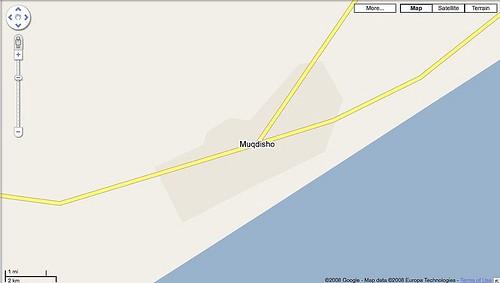
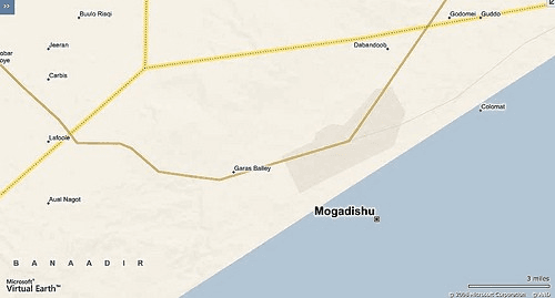
Mogadishu
OpenStreetMap
Microsoft Virtual Earth
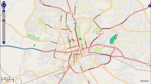
Harare
Open Street Map
Microsoft Virtual Earth
The great coverage provided by OpenStreetMap in a lot of the places that our partner organizations care about is only one of the wins. Since it’s an open data set, the contributions everyone makes to the data will ripple out across the community and benefit everyone else involved. As the project continues to grow in popularity, the data will continue to grow more accurate and more complete. Just look at this fantastic animation showing all the great work that was done on the OSM project during 2008.
OSM 2008: A Year of Edits from ItoWorld on Vimeo.
The project is only looking to grow stronger in 2009.
What we're doing.
Latest