Data
Photographic Aerial Survey
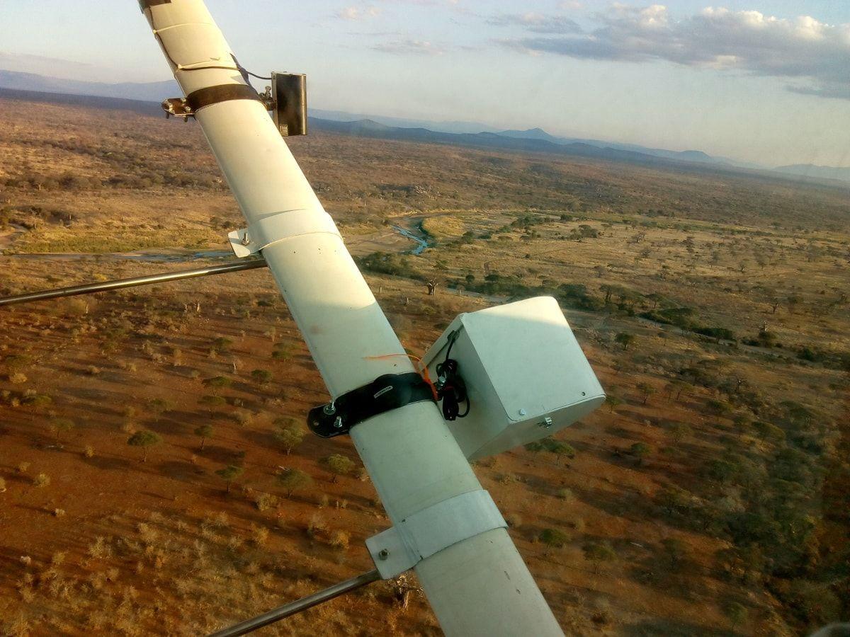
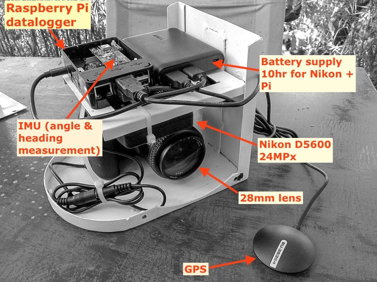
The traditional human-eye detection is still the main method in use to intiiate image captures containing objects of interest, but studies testing high-resolution photographic systems, or Photographic Aerial Surveys (PAS), will hopefully become a replacement. The new system uses cameras on the wing struts which take constant images along flight paths.
- These images have no intervening Plexiglas and are much higher quality.
- Taken at 45° down-angle, and with a lens that mimics the same sample field of view as the human eye.
- 24MP and optimized for image sharpness.
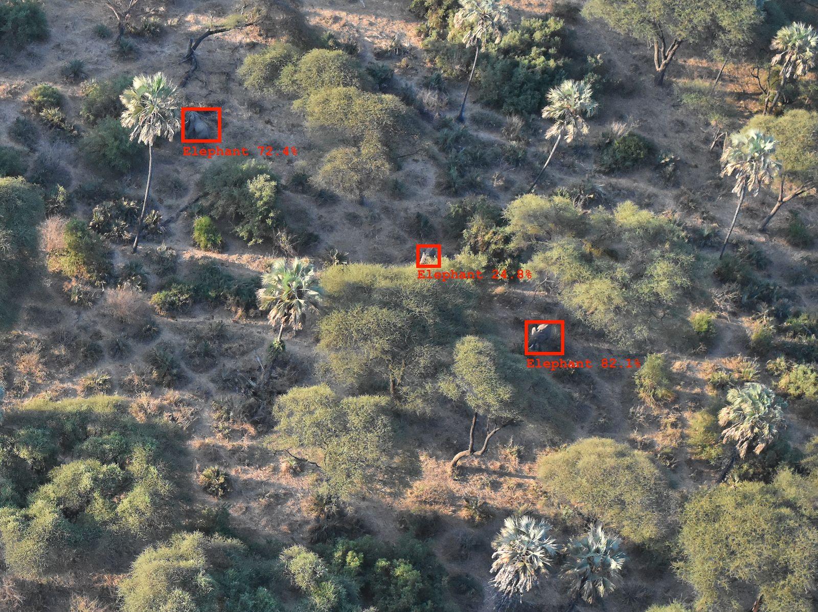
- Very low rate of 'positives' - perhaps 2% of images will have any wildlife or livestock present.
- Around 500,000 images are available and more are being collected every year.
- GPS metadata present for all images.
- Overlapping images are taken at 2-second intervals.