


Scalable STAC Catalog
eoAPI provides a straightforward way to deploy a STAC catalog that can scale dramatically. STAC defines how we browse imagery (and now vector data) by space, time, and other attributes like cloud cover. eoAPI ships with the open-source project PgSTAC, a STAC extension for PostgreSQL databases. The extension provides convenient methods to create, search, query, update, and delete STAC collections and items through the Python library PyPgSTAC. The catalog can be integrated with any application using stac-fastapi, a FastAPI-based STAC API implementation that powers some of the largest open geospatial data catalogs.
Dynamic Tiling
Building a searchable catalog is only part of the puzzle. Most geospatial users need a way to access relevant data slices for analysis and visualization. Through ecosystems like Jupyter, the browser is becoming the default analysis environment alongside desktop tools like QGIS. eoAPI provides highly performant services based on TiTiler for raster and TiPg for vector tiling. TiTiler can serve tiles on demand from a COG. TiPg relies on the OGC Features API specification to serve vector data, making it incredibly easy to pull data into analysis tools. Both can connect directly to a PgSTAC database and create tiles in seconds. eoAPI also comes with TiTiler-PgSTAC, which can create and serve mosaics based on a STAC search query. Compared to the traditional static tiling approach, dynamic tiling has a drastically lower memory and compute footprint.


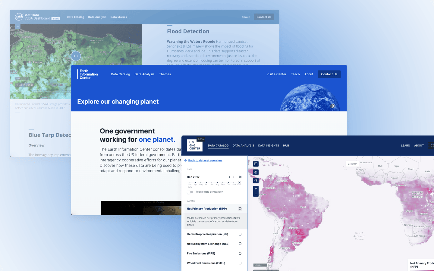
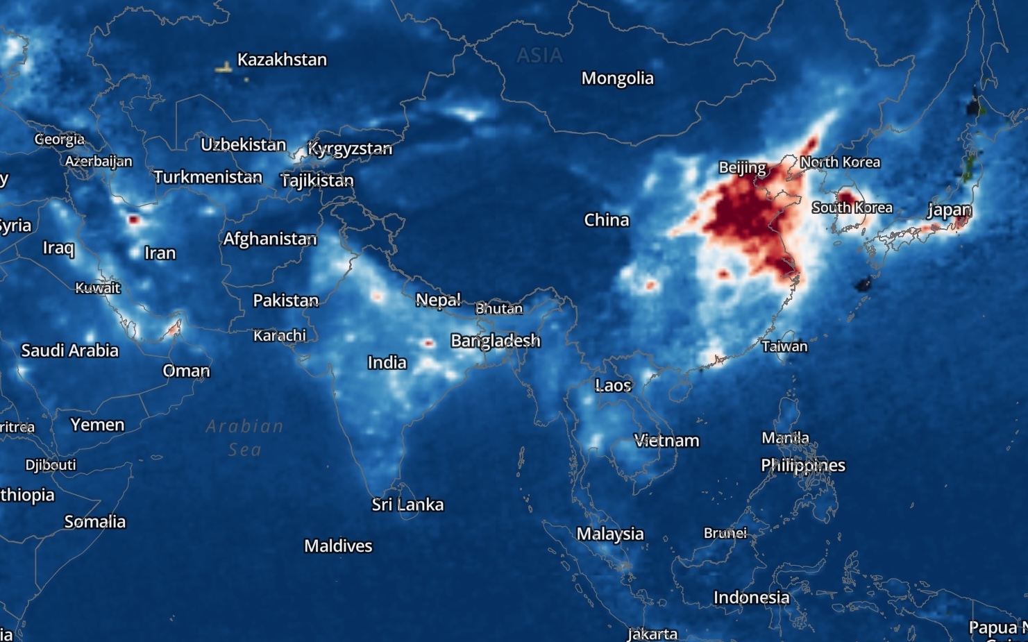
Image by Development Seed
The newly launched Earth Information Center catalog, the US Greenhouse Gas Center and NASA's VEDA platform are all powered by eoAPI.
What we're doing.
Latest